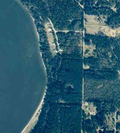
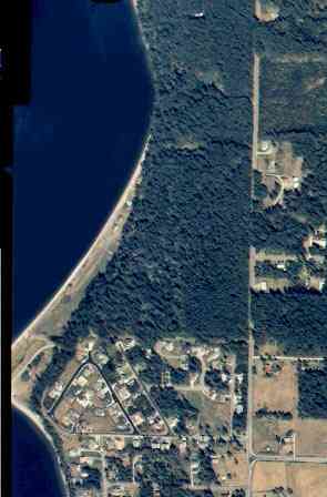
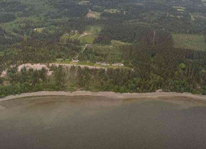
The above September 1997 aerial photo of this section of Camano is from http://www.islandcounty.net/publicworks/digitalphotos/mainmap.htm
The above September 1997 aerial photo of this section of Camano is from
http://www.islandcounty.net/publicworks/digitalphotos/mainmap.htm
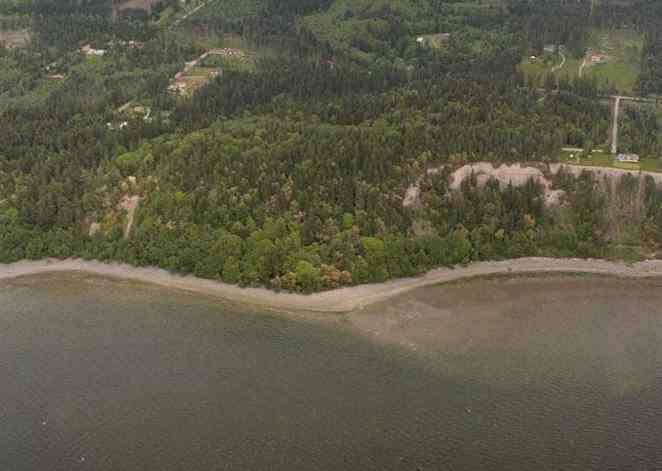
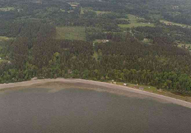
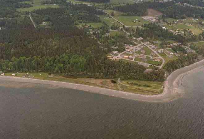
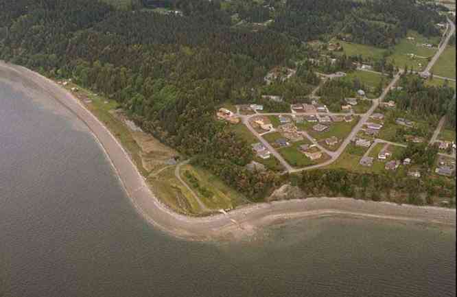
The below 5/8/1993 2:30:00 PM aerial photos are from:
http://apps.ecy.wa.gov/shorephotos
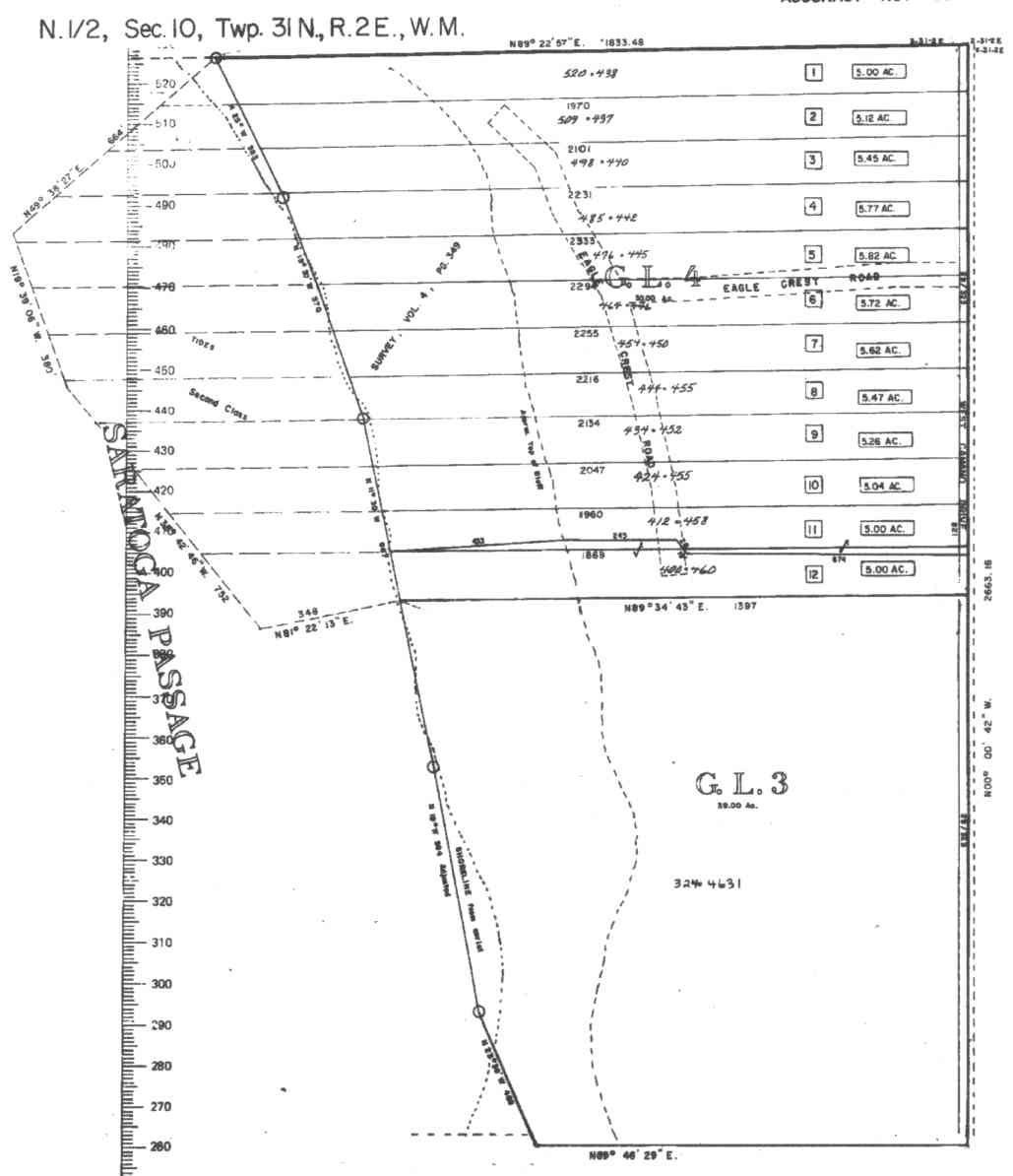
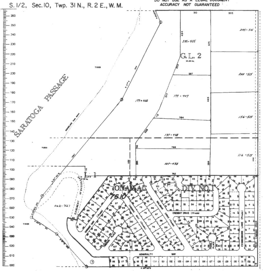
A square system of surveying was ordained by the Continental Congress on May 20, 1785. Within each township (6 miles X 6 miles), are 36 sections. Each section of 640 acres is one mile square (5,280 feet X 5,280 feet). Each quarter section is 160 acres (2,640 feet X 2,640 feet). Most long straight roads and acreage pieces of property have north-south, east-west property lines.
Click on the below Camano section map numbers, to go to a page with Camano Island 2005 assessor data, 1/4 section parcel maps, and aerial photos.
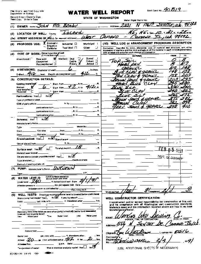
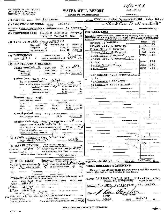
Below are the 3 well reports for this section of Camano, from the December 2004 Washington State Department of Ecology Well log website. Included below is who the well was drilled for, the well depth, and when the well was drilled. At the well log website,
http://apps.ecy.wa.gov/welllog/ more detailed information is available, like the well drillers name, water temperature(sometimes), and soil profile depths.
The below well logs information is from the Washington State Department of Ecology Well log website.
http://apps.ecy.wa.gov/welllog/
 <888>
<888>

JOHN MC BRADY
Public Land Survey: NE, NE, S-10, T-31-N, R-02-E
County: ISLAND, Well Address: W CAMANO, CAMANO ISLAND, 98292
Well Log ID: 80232 , Notice of Intent Number: 040819
Well Diameter: 6 (inches), Well Depth: 412 (feet)
Well Type: Water, Well Completion Date: 2/4/1991, Well Log Received Date: 2/5/1991


JON STONEMAN
Public Land Survey: NE, NE, S-10, T-31-N, R-02-E, Tax Parcel Number: R23110-454-4500
County: ISLAND, Well Address: EAGLE CREST WY
Well Log ID: 80411, Well Tag ID: AKY732
Well Diameter: 6 (inches), Well Depth: 280 (feet)
Well Type: Water, Well Completion Date: 5/27/1987


ROY LANDER
Public Land Survey: SE, SW, S-10, T-31-N, R-02-E
County: ISLAND, Well Address: 1010 W WATERLOO, 98277
Well Log ID: 84181 , Notice of Intent Number: 027890
Well Diameter: 6 (inches), Well Depth: 207 (feet)
Well Type: Water, Well Completion Date: 6/27/1989, Well Log Received Date: 6/29/1989
wr23110eaglecreststoneman1987dalhman
wr23110wcamanobrady1991watkins