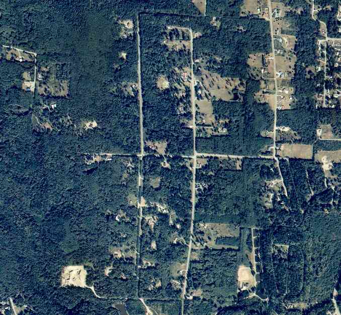
The above September 1997 aerial photo of this section of Camano is from http://www.islandcounty.net/publicworks/digitalphotos/mainmap.htm
The above September 1997 aerial photo of this section of Camano is from
http://www.islandcounty.net/publicworks/digitalphotos/mainmap.htm
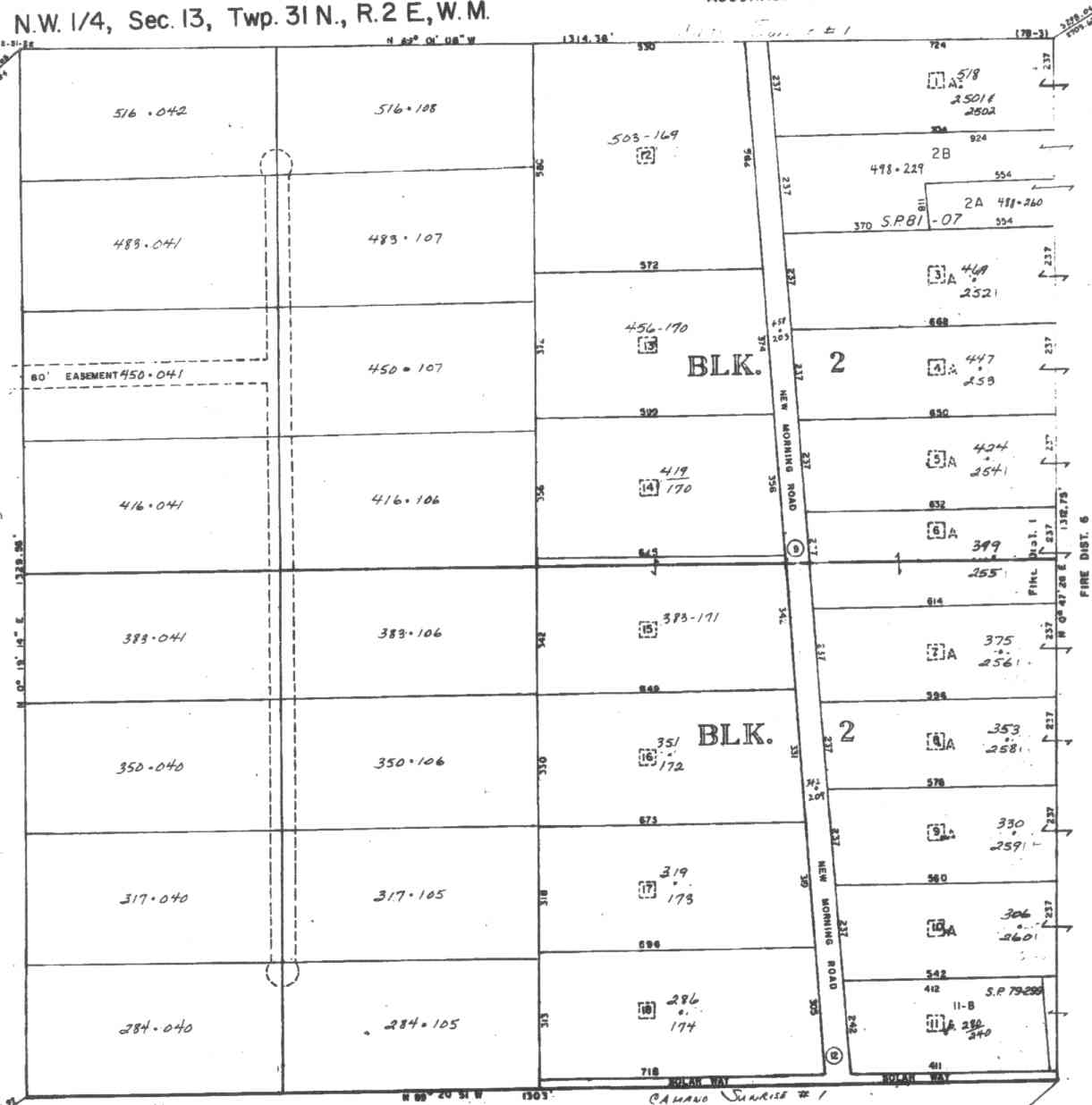
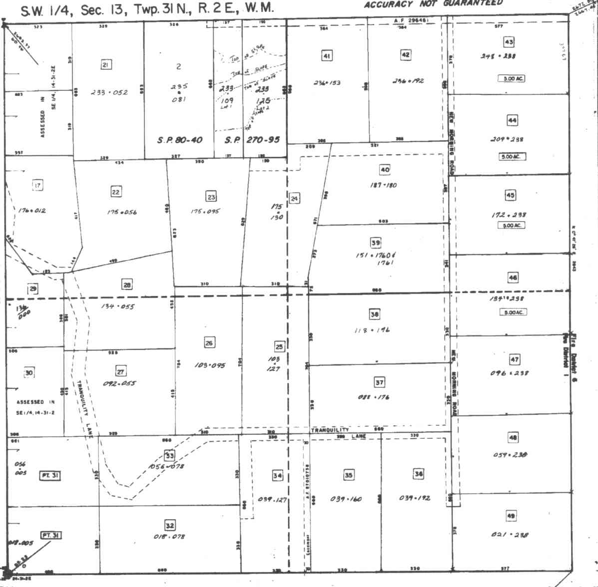
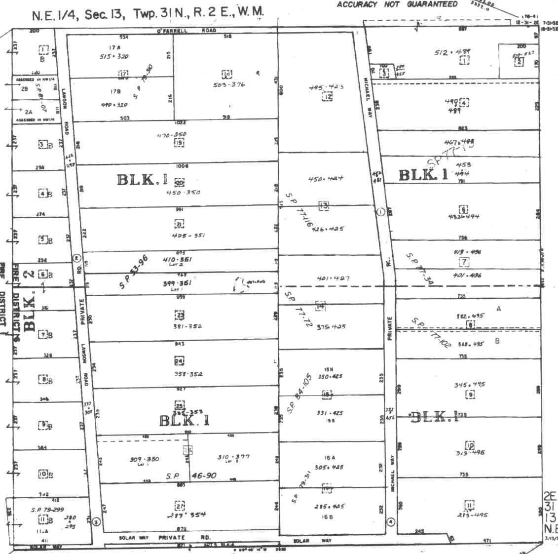
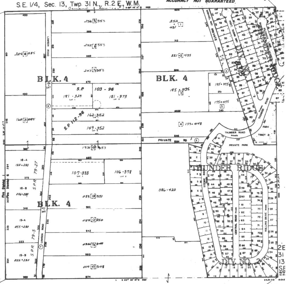
A square system of surveying was ordained by the Continental Congress on May 20, 1785. Within each township (6 miles X 6 miles), are 36 sections. Each section of 640 acres is one mile square (5,280 feet X 5,280 feet). Each quarter section is 160 acres (2,640 feet X 2,640 feet). Most long straight roads and acreage pieces of property have north-south, east-west property lines.
Click on the below Camano section map numbers, to go to a page with Camano Island 2005 assessor data, 1/4 section parcel maps, and aerial photos.
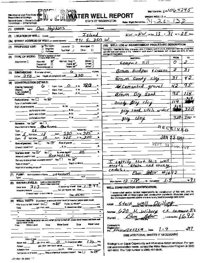
Below are the 11 well reports for this section of Camano, from the December 2004 Washington State Department of Ecology Well log website. Included below is who the well was drilled for, the well depth, and when the well was drilled. At the well log website,
http://apps.ecy.wa.gov/welllog/ more detailed information is available, like the well drillers name, water temperature(sometimes), and soil profile depths.
The below well logs information is from the Washington State Department of Ecology Well log website.
http://apps.ecy.wa.gov/welllog/
 <888>
<888>

ALLEN GILBERTSON
Public Land Survey: NE, NE, S-13, T-31-N, R-02-E
County: ISLAND
Well Log ID: 74350, Well Tag ID: AGA712
Well Diameter: 8 (inches), Well Depth: 212 (feet)
Well Type: Water, Well Completion Date: 4/26/1977
JON STONEMAN
Public Land Survey: NW, NE, S-13, T-31-N, R-02-E
County: ISLAND, Well Address: 226 SW CAMANO ISLAND, CAMANO ISLAND
Well Log ID: 80412 , Notice of Intent Number: W000366
Well Diameter: 6 (inches), Well Depth: 417 (feet)
Well Type: Water, Well Completion Date: 11/8/1993, Well Log Received Date: 11/16/1993
CAMANO ASSOC
Public Land Survey: SW, NE, S-13, T-31-N, R-02-E
County: ISLAND, Well Address: 1080 NEW MORNING RD
Well Log ID: 378219, Well Tag ID: AGA724
Well Diameter: 6 (inches), Well Depth: 106 (feet)
Well Type: Water, Well Completion Date: 4/15/1981, Well Log Received Date: 4/22/1981
DON HOPKINS
Public Land Survey: NW, NW, S-13, T-31-N, R-02-E
County: ISLAND, Well Address: 971 S 350 W
Well Log ID: 77086 , Notice of Intent Number: W064245
Well Diameter: 6 (inches), Well Depth: 330 (feet)
Well Type: Water, Well Completion Date: 1/9/1997, Well Log Received Date: 1/23/1997
MORRIS LONGBERG
Public Land Survey: SE, NW, S-13, T-31-N, R-02-E
County: ISLAND, Well Address: 400 FORREST WY, CAMANO ISLAND
Well Log ID: 190362, Well Tag ID: AEF900, Notice of Intent Number: W094533
Well Diameter: 6 (inches), Well Depth: 34 (feet)
Well Type: Water, Well Completion Date: 6/15/1999, Well Log Received Date: 9/16/1999
SCOTT LANGBERT
Public Land Survey: SW, NW, S-13, T-31-N, R-02-E
County: ISLAND
Well Log ID: 84397
Well Diameter: 6 (inches), Well Depth: 385 (feet)
Well Type: Water, Well Completion Date: 8/3/1980, Well Log Received Date: 5/14/1992
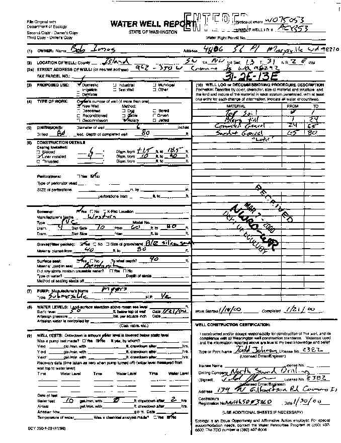
BOB IMOS
Public Land Survey: SW, NW, S-13, T-31-N, R-02-E
County: ISLAND, Well Address: 962 - 350TH W., CAMANO ISLAND, WA 98292
Well Log ID: 248137, Well Tag ID: ACY353, Notice of Intent Number: W075053
Well Diameter: 6 (inches), Well Depth: 80 (feet)
Well Type: Water, Well Completion Date: 1/21/2000, Well Log Received Date: 3/7/2000
SELMA JOHNSON
Public Land Survey: NW, SE, S-13, T-31-N, R-02-E
County: ISLAND, Well Address: WOODLAND BEACH
Well Log ID: 84444
Well Diameter: 6 (inches), Well Depth: 31 (feet)
Well Type: Water, Well Completion Date: 2/5/1992, Well Log Received Date: 3/9/1992
GTE
Public Land Survey: SE, SE, S-13, T-31-N, R-02-E
County: ISLAND, Well Address: WANAMAKER RD, WHIDBEY ISLAND
Well Log ID: 78675 , Notice of Intent Number: 048293
Well Diameter: 6 (inches), Well Depth: 200 (feet)
Well Type: Water, Well Completion Date: 4/1/1993, Well Log Received Date: 5/4/1993
CAMANO SUNRISE COMM. ASSN.
Public Land Survey: NE, SW, S-13, T-31-N, R-02-E
County: ISLAND
Well Log ID: 75555, Well Tag ID: AGA709
Well Diameter: 8 (inches), Well Depth: 101 (feet)
Well Type: Water
KEN GILBERTSON
Public Land Survey: NE, SW, S-13, T-31-N, R-02-E
County: ISLAND, Well Address: LAWSON
Well Log ID: 80667 , Notice of Intent Number: 023257
Well Diameter: 6 (inches), Well Depth: 150 (feet)
Well Type: Water, Well Completion Date: 6/8/1987
wr23113hopkins1997stein
wr23113imus2000johnson