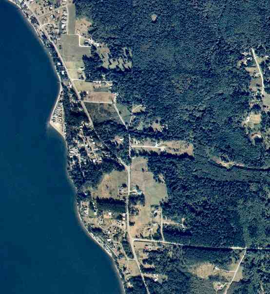
The above September 1997 aerial photo of this section of Camano is from http://www.islandcounty.net/publicworks/digitalphotos/mainmap.htm
The above September 1997 aerial photo of this section of Camano is from
http://www.islandcounty.net/publicworks/digitalphotos/mainmap.htm
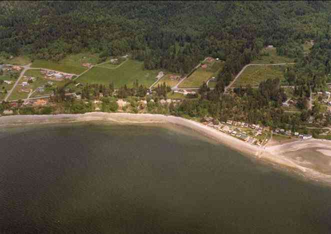
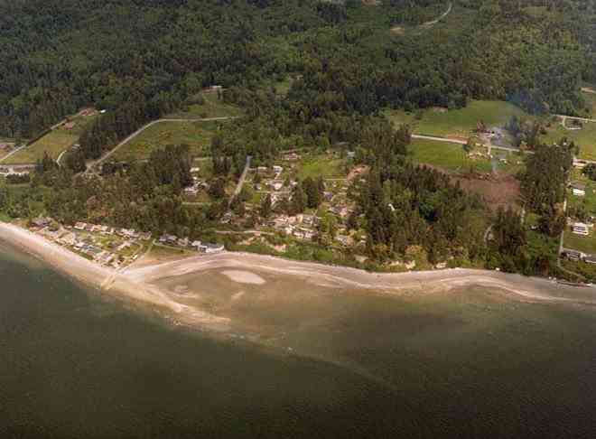
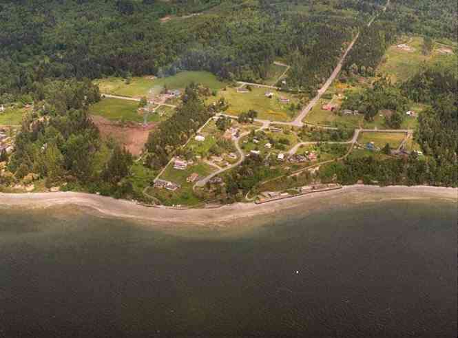
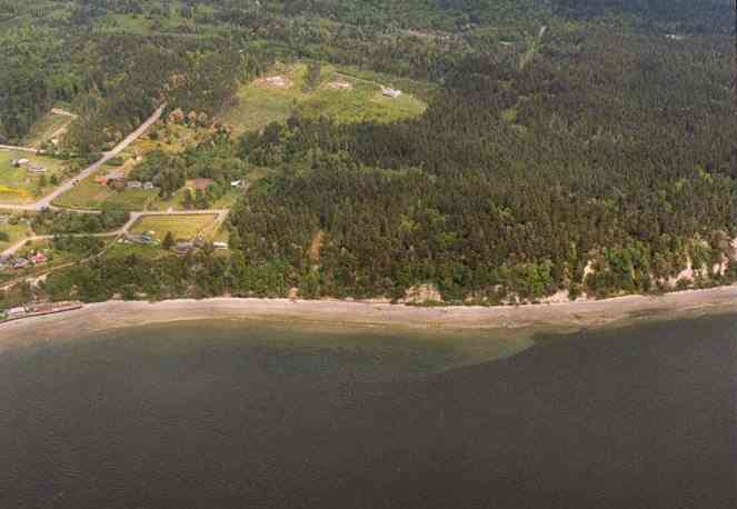
The below 5/8/1993 2:30:00 PM aerial photos are from:
http://apps.ecy.wa.gov/shorephotos
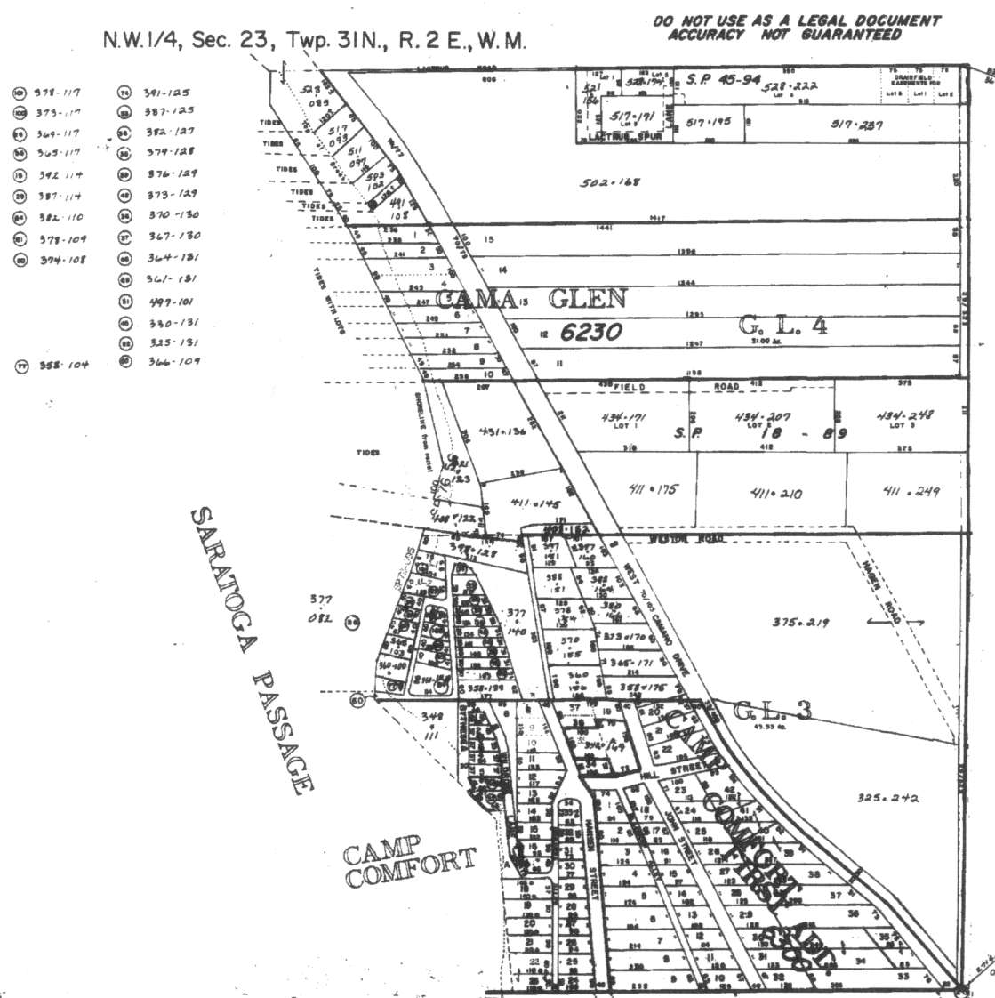
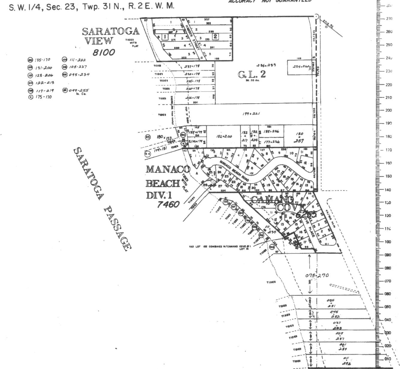
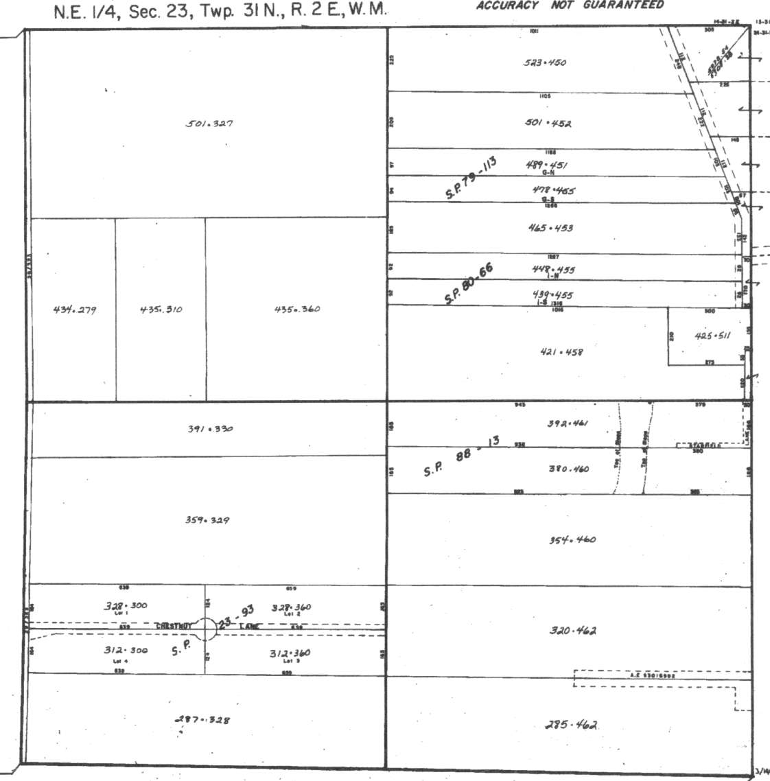
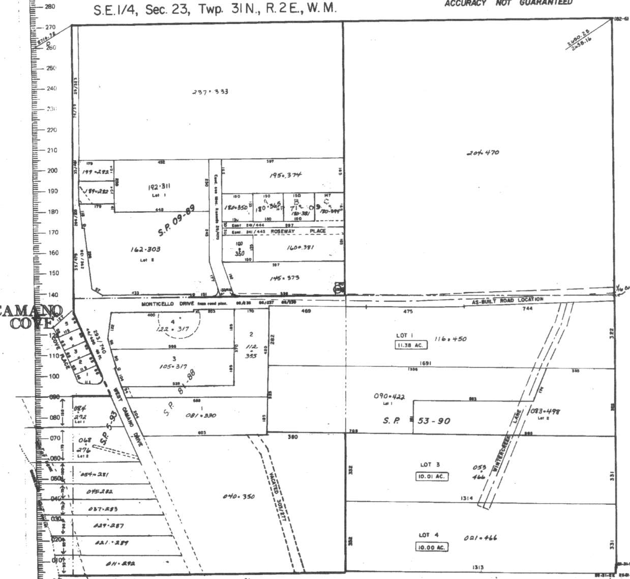
A square system of surveying was ordained by the Continental Congress on May 20, 1785. Within each township (6 miles X 6 miles), are 36 sections. Each section of 640 acres is one mile square (5,280 feet X 5,280 feet). Each quarter section is 160 acres (2,640 feet X 2,640 feet). Most long straight roads and acreage pieces of property have north-south, east-west property lines.
Click on the below Camano section map numbers, to go to a page with Camano Island 2005 assessor data, 1/4 section parcel maps, and aerial photos.
Below are the 7 well reports for this section of Camano, from the December 2004 Washington State Department of Ecology Well log website. Included below is who the well was drilled for, the well depth, and when the well was drilled. At the well log website,
http://apps.ecy.wa.gov/welllog/ more detailed information is available, like the well drillers name, water temperature(sometimes), and soil profile depths.
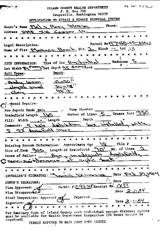
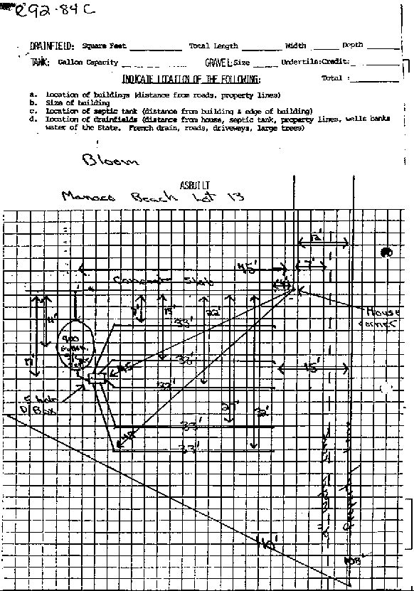
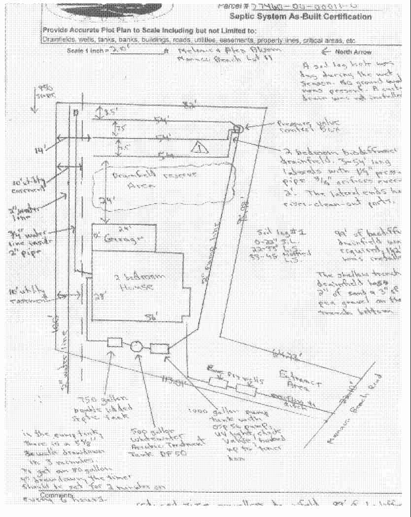
Below are septic system as-builts, permits, site registrations sheets, well reports, maps, ect.., from this Camano Island section.
 <888>
<888>

DEAN SCHWARTZ
Public Land Survey: SE, NE, S-23, T-31-N, R-02-E
County: ISLAND, Well Address: 1332 S MIDCREST RD, CAMANO ISLAND, 98292
Well Log ID: 76785
Well Diameter: 6 (inches), Well Depth: 440 (feet)
Well Type: Water, Well Completion Date: 8/17/1992, Well Log Received Date: 8/24/1992


MULLIGAN SHEILA
Public Land Survey: SE, NE, S-23, T-31-N, R-02-E
County: ISLAND, Well Address: 1370 & 1380 MIDCREST LANE
Well Log ID: 247754, Well Tag ID: AEP777, Notice of Intent Number: W117644
Well Diameter: 6 (inches), Well Depth: 14 (feet)
Well Type: Water, Well Completion Date: 6/14/2000, Well Log Received Date: 7/18/2000


CAMANO CO - OP WATER & POWER
Public Land Survey: SW, NE, S-23, T-31-N, R-02-E
County: ISLAND
Well Log ID: 75537, Well Tag ID: AGA651
Well Diameter: 8 (inches), Well Depth: 316 (feet)
Well Type: Water, Well Completion Date: 12/26/1984, Well Log Received Date: 3/27/1987


BAXTER SIMS
Public Land Survey: NW, SE, S-23, T-31-N, R-02-E
County: ISLAND
Well Log ID: 74650
Well Diameter: 6 (inches), Well Depth: 436 (feet)
Well Type: Water, Well Completion Date: 11/21/1983, Well Log Received Date: 6/17/1987


SCENIC BEACH WATER ASSOC.
Public Land Survey: NW, SE, S-23, T-31-N, R-02-E
County: ISLAND, Well Address: 1101 N SCENIC AVE
Well Log ID: 84353
Well Diameter: 6 (inches), Well Depth: 21 (feet)
Well Type: Water, Well Completion Date: 5/20/1998, Well Log Received Date: 6/16/1998


BILL BRADLEY
Public Land Survey: SE, SW, S-23, T-31-N, R-02-E
County: ISLAND
Well Log ID: 74787 , Notice of Intent Number: 042033
Well Diameter: 6 (inches), Well Depth: 241 (feet)
Well Type: Water, Well Completion Date: 7/2/1991, Well Log Received Date: 7/12/1991


G T E NORTHWEST
Public Land Survey: SE, SW, S-23, T-31-N, R-02-E
County: ISLAND, Well Address: MONDEO BEACH
Well Log ID: 78087 , Notice of Intent Number: 072616
Well Diameter: 6 (inches), Well Depth: 200 (feet)
Well Type: Water, Well Completion Date: 9/12/1990