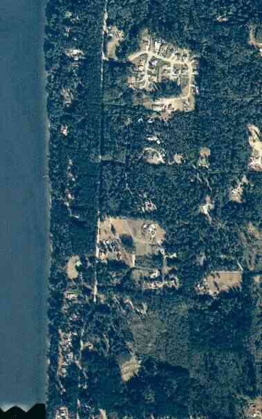
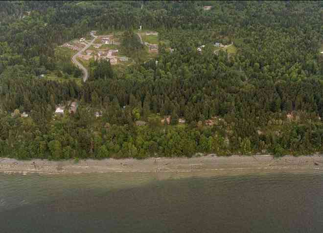
The above September 1997 aerial photo of this section of Camano is from http://www.islandcounty.net/publicworks/digitalphotos/mainmap.htm
The above September 1997 aerial photo of this section of Camano is from
http://www.islandcounty.net/publicworks/digitalphotos/mainmap.htm
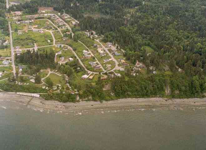
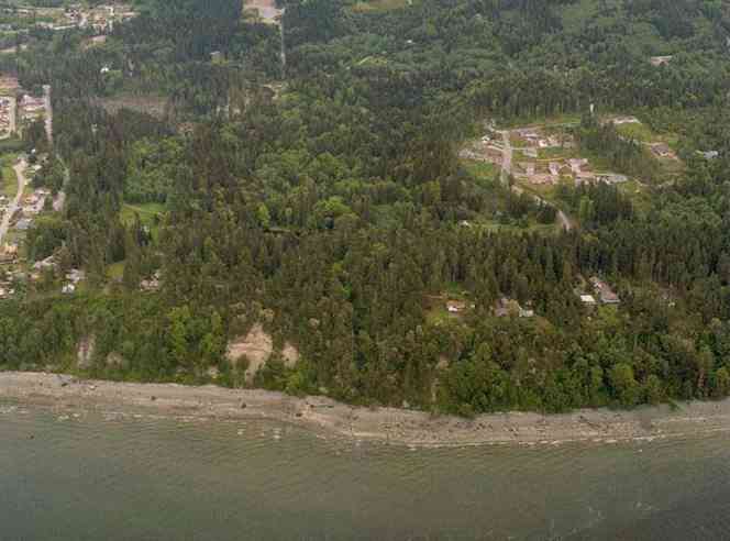
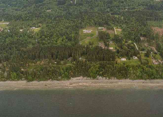
The below 5/8/1993 2:30:00 PM aerial photos are from:
http://apps.ecy.wa.gov/shorephotos
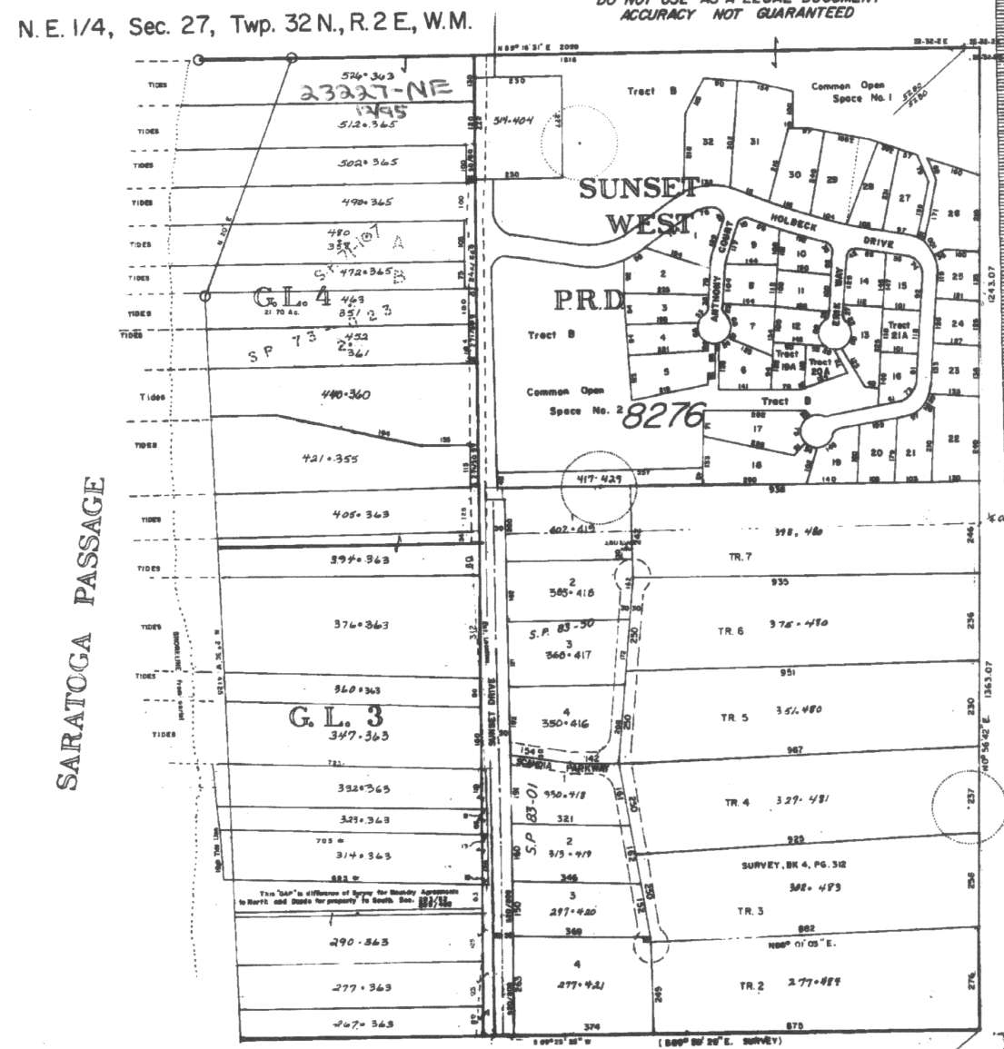
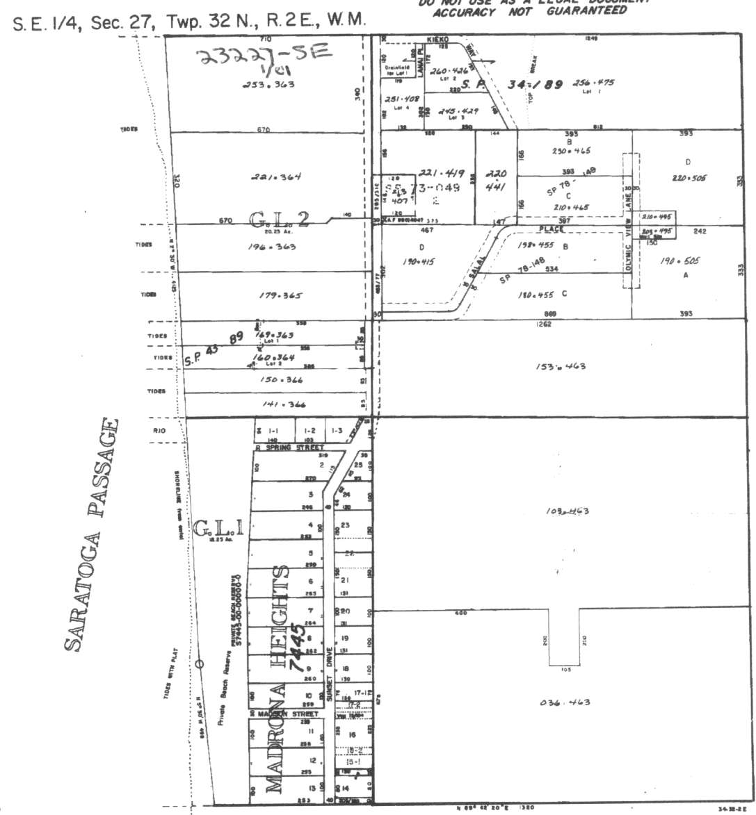
A square system of surveying was ordained by the Continental Congress on May 20, 1785. Within each township (6 miles X 6 miles), are 36 sections. Each section of 640 acres is one mile square (5,280 feet X 5,280 feet). Each quarter section is 160 acres (2,640 feet X 2,640 feet). Most long straight roads and acreage pieces of property have north-south, east-west property lines.
Click on the below Camano section map numbers, to go to a page with Camano Island 2005 assessor data, 1/4 section parcel maps, and aerial photos.
Below are the 8 well reports for this section of Camano, from the December 2004 Washington State Department of Ecology Well log website. Included below is who the well was drilled for, the well depth, and when the well was drilled. At the well log website,
http://apps.ecy.wa.gov/welllog/ more detailed information is available, like the well drillers name, water temperature(sometimes), and soil profile depths.
The below well logs information is from the Washington State Department of Ecology Well log website.
http://apps.ecy.wa.gov/welllog/
 <888>
<888>

1. MIKE HARRISĀ - { view PDF
Ā|Ā view TIFF
}
Public Land Survey: NE, SE, S-27, T-32-N, R-02-E, Tax Parcel Number: (blank)
County: ISLAND, Well Address: 510 SUNSET DR, CAMANO ISLAND, 98292
Well Log ID: 68005, Well Tag ID: (blank) , Notice of Intent Number: 070891
Well Diameter: 6 (inches), Well Depth: 153 (feet)
Well Type: Water, Well Completion Date: 6/10/1993, Well Log Received Date: 6/18/1993
2. RICHARD BERGERĀ - { view PDF
Ā|Ā view TIFF
}
Public Land Survey: SE, SE, S-27, T-32-N, R-02-E, Tax Parcel Number: (blank)
County: ISLAND, Well Address: 408 N ROBERTS WY, CAMANO ISLAND
Well Log ID: 69678, Well Tag ID: (blank) , Notice of Intent Number: 070382
Well Diameter: 6 (inches), Well Depth: 223 (feet)
Well Type: Water, Well Completion Date: 1/7/1991, Well Log Received Date: (blank)
3. FIELDS WATER ASSN.Ā - { view PDF
Ā|Ā view TIFF
}
Public Land Survey: SE, SE, S-27, T-32-N, R-02-E, Tax Parcel Number: (blank)
County: ISLAND, Well Address: (blank)
Well Log ID: 64193, Well Tag ID: (blank) , Notice of Intent Number: (blank)
Well Diameter: 6 (inches), Well Depth: 250 (feet)
Well Type: Water, Well Completion Date: 7/18/1980, Well Log Received Date: (blank)
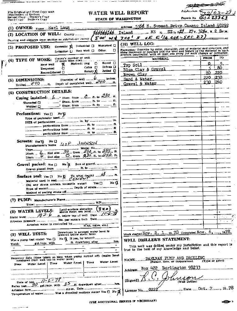
4. EARL LAUNĀ - { view PDF
Ā|Ā view TIFF
}
Public Land Survey: NE, SE, S-27, T-32-N, R-02-E, Tax Parcel Number: (blank)
County: ISLAND, Well Address: (blank)
Well Log ID: 63859, Well Tag ID: (blank) , Notice of Intent Number: (blank)
Well Diameter: 6 (inches), Well Depth: 240 (feet)
Well Type: Water, Well Completion Date: 11/6/1978, Well Log Received Date: (blank)
5. PALISADES ASSN INCĀ - { view PDF
Ā|Ā view TIFF
}
Public Land Survey: NE, NE, S-27, T-32-N, R-02-E, Tax Parcel Number: (blank)
County: ISLAND, Well Address: (blank)
Well Log ID: 68983, Well Tag ID: AGA741, Notice of Intent Number: (blank)
Well Diameter: 8 (inches), Well Depth: 173 (feet)
Well Type: Water, Well Completion Date: 7/9/1970, Well Log Received Date: (blank)
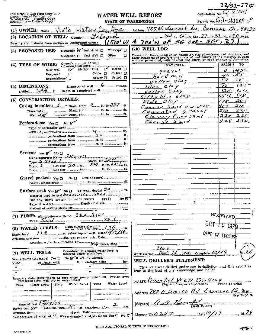
6. VISTA WATER CO INCĀ - { view PDF
Ā|Ā view TIFF
}
Public Land Survey: SW, SE, S-27, T-32-N, R-02-E, Tax Parcel Number: S7445-00-00007
County: ISLAND, Well Address: (blank)
Well Log ID: 71460, Well Tag ID: AKY743, Notice of Intent Number: (blank)
Well Diameter: 6 (inches), Well Depth: 234 (feet)
Well Type: Water, Well Completion Date: 12/19/1966, Well Log Received Date: 10/19/1979
7. JACK HEBCOXĀ - { view PDF
Ā|Ā view TIFF
}
Public Land Survey: (blank), NE, S-27, T-32-N, R-02-E, Tax Parcel Number: (blank)
County: ISLAND, Well Address: (blank)
Well Log ID: 65460, Well Tag ID: (blank) , Notice of Intent Number: (blank)
Well Diameter: 6 (inches), Well Depth: 181 (feet)
Well Type: Water, Well Completion Date: (blank) , Well Log Received Date: (blank)
8. STUART SMITHĀ - { view PDF
Ā|Ā view TIFF
}
Public Land Survey: (blank), (blank), S-27, T-32-N, R-02-E, Tax Parcel Number: 57445-00-00012-0
County: ISLAND, Well Address: 409 N SUNSET DRIVE
Well Log ID: 388643, Well Tag ID: AKB102, Notice of Intent Number: (blank)
Well Diameter: 6 (inches), Well Depth: 138 (feet)
Well Type: Water, Well Completion Date: (blank) , Well Log Received Date: 9/22/2004
wr23227sunsetvistawater1979kounkel
wr23227sunsetlaun1978dahlman