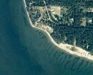
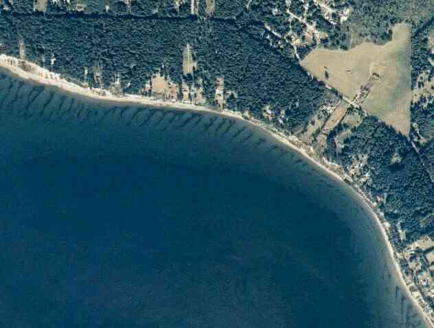
The above September 1997 aerial photo of this section of Camano is from http://www.islandcounty.net/publicworks/digitalphotos/mainmap.htm http://apps.ecy.wa.gov/shorephotos
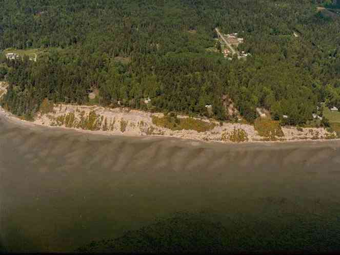
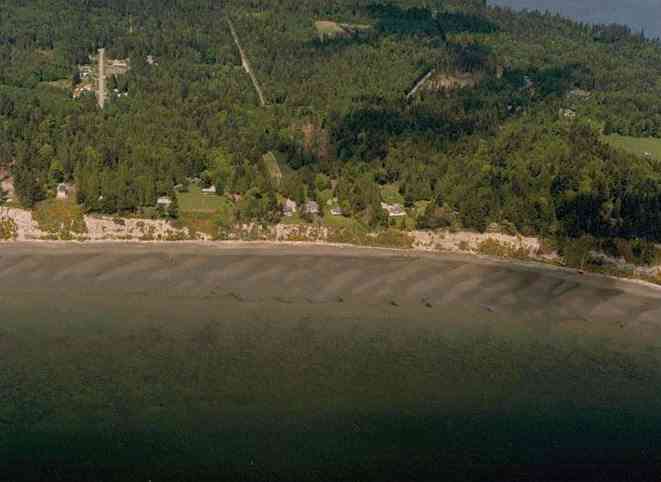
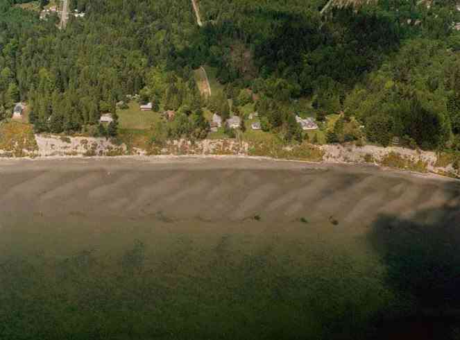
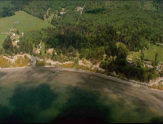
The above September 1997 aerial photo of this section of Camano is from
http://www.islandcounty.net/publicworks/digitalphotos/mainmap.htm
http://apps.ecy.wa.gov/shorephotos
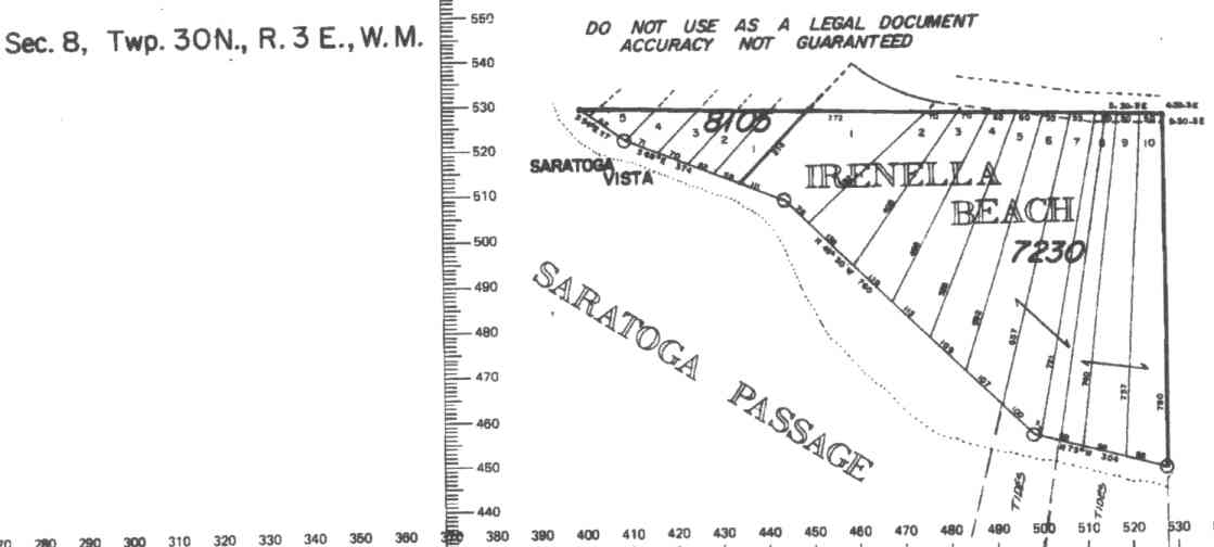
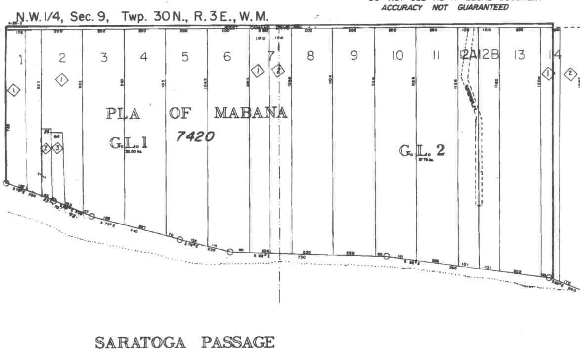
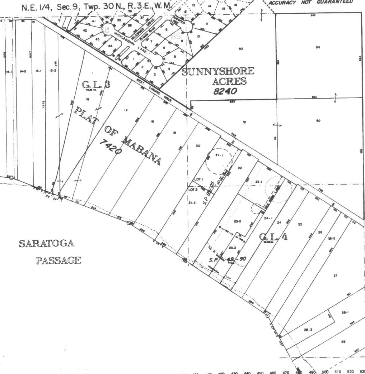
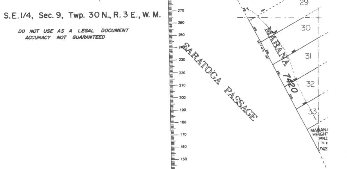
A square system of surveying was ordained by the Continental Congress on May 20, 1785. Within each township (6 miles X 6 miles), are 36 sections. Each section of 640 acres is one mile square (5,280 feet X 5,280 feet). Each quarter section is 160 acres (2,640 feet X 2,640 feet). Most long straight roads and acreage pieces of property have north-south, east-west property lines.
Click on the below Camano section map numbers, to go to a page with Camano Island 2005 assessor data, 1/4 section parcel maps, and aerial photos.
Below are the 11 well reports for this section of Camano, from the December 2004 Washington State Department of Ecology Well log website. Included below is who the well was drilled for, the well depth, and when the well was drilled. At the well log website,
http://apps.ecy.wa.gov/welllog/ more detailed information is available, like the well drillers name, water temperature(sometimes), and soil profile depths.
 <888>
<888>

1. MARY KAY RYANĀ - { view PDF
Public Land Survey: SW, NE, S-09, T-30-N, R-03-E, Tax Parcel Number: (blank)
County: ISLAND, Well Address: 2844A W CAMANO DR, CAMANO ISLAND
Well Log ID: 81765, Well Tag ID: (blank) , Notice of Intent Number: W075894
Well Diameter: 6 (inches), Well Depth: 199 (feet)
Well Type: Water, Well Completion Date: 10/17/1997, Well Log Received Date: 10/31/1997
2. JOHN DOROTIKĀ
Public Land Survey: SW, NW, S-09, T-30-N, R-03-E, Tax Parcel Number: (blank)
County: ISLAND, Well Address: BROADMOOR AND SW CAMANO, CAMANO ISLAND
Well Log ID: 80114, Well Tag ID: (blank) , Notice of Intent Number: W043151
Well Diameter: 6 (inches), Well Depth: 242 (feet)
Well Type: Water, Well Completion Date: 4/6/1994, Well Log Received Date: 5/16/1994
3. J.THOMAS SHARPĀ
Public Land Survey: (blank), NE, S-09, T-30-N, R-03-E, Tax Parcel Number: (blank)
County: ISLAND, Well Address: CAMANO ISLAND, 98292
Well Log ID: 79150, Well Tag ID: (blank) , Notice of Intent Number: 210321
Well Diameter: 6 (inches), Well Depth: 200 (feet)
Well Type: Water, Well Completion Date: 3/15/1993, Well Log Received Date: 4/9/1993
4. MIKE BROWNĀ
Public Land Survey: NW, NW, S-09, T-30-N, R-03-E, Tax Parcel Number: (blank)
County: ISLAND, Well Address: (blank)
Well Log ID: 82011, Well Tag ID: (blank) , Notice of Intent Number: 073005
Well Diameter: 6 (inches), Well Depth: 182 (feet)
Well Type: Water, Well Completion Date: 9/6/1991, Well Log Received Date: 9/30/1991
5. VITO MONNIĀ
Public Land Survey: NW, NE, S-09, T-30-N, R-03-E, Tax Parcel Number: (blank)
County: ISLAND, Well Address: (blank)
Well Log ID: 85616, Well Tag ID: (blank) , Notice of Intent Number: 042035
Well Diameter: 6 (inches), Well Depth: 180 (feet)
Well Type: Water, Well Completion Date: 6/3/1991, Well Log Received Date: 6/17/1991
6. EVAN HOLZKNECHTĀ
Public Land Survey: NW, (blank), S-09, T-30-N, R-03-E, Tax Parcel Number: (blank)
County: ISLAND, Well Address: 794 E CAMANO DR
Well Log ID: 77786, Well Tag ID: (blank) , Notice of Intent Number: 072654
Well Diameter: 6 (inches), Well Depth: 230 (feet)
Well Type: Water, Well Completion Date: 5/31/1991, Well Log Received Date: 6/4/1991
7. PETE CALLISONĀ
Public Land Survey: NE, NE, S-09, T-30-N, R-03-E, Tax Parcel Number: S7420-00-00023-1
County: ISLAND, Well Address: SEA SONG LN AND W CAMANO DR
Well Log ID: 285492, Well Tag ID: AKY799, Notice of Intent Number: (blank)
Well Diameter: 6 (inches), Well Depth: 200 (feet)
Well Type: Water, Well Completion Date: 5/24/1991, Well Log Received Date: 6/4/1991
8. EVAN HOLZKNECHTĀ
Public Land Survey: NW, SW, S-09, T-30-N, R-03-E, Tax Parcel Number: (blank)
County: ISLAND, Well Address: 794 E CAMANO DR, CAMANO ISLAND
Well Log ID: 77787, Well Tag ID: (blank) , Notice of Intent Number: 072654
Well Diameter: 6 (inches), Well Depth: 196 (feet)
Well Type: Water, Well Completion Date: 5/15/1991, Well Log Received Date: 5/30/1991
9. JOH DOROTIKĀ
Public Land Survey: (blank), NE, S-09, T-30-N, R-03-E, Tax Parcel Number: (blank)
County: ISLAND, Well Address: 2916 SW CAMANO DR, CAMANO ISLAND, 98292
Well Log ID: 80019, Well Tag ID: (blank) , Notice of Intent Number: 023266
Well Diameter: 6 (inches), Well Depth: 196 (feet)
Well Type: Water, Well Completion Date: 9/5/1989, Well Log Received Date: 9/11/1989
10. DR. GREGORY JOHN & BRUCE MAINEĀ
Public Land Survey: NW, NW, S-09, T-30-N, R-03-E, Tax Parcel Number: (blank)
County: ISLAND, Well Address: (blank)
Well Log ID: 77337, Well Tag ID: (blank) , Notice of Intent Number: (blank)
Well Diameter: 6 (inches), Well Depth: 163 (feet)
Well Type: Water, Well Completion Date: 7/24/1984, Well Log Received Date: 9/12/1984
11. DONALD FARNERĀ
Public Land Survey: NW, NW, S-09, T-30-N, R-03-E, Tax Parcel Number: (blank)
County: ISLAND, Well Address: (blank)
Well Log ID: 77185, Well Tag ID: (blank) , Notice of Intent Number: (blank)
Well Diameter: 6 (inches), Well Depth: 166 (feet)
Well Type: Water, Well Completion Date: 4/7/1981, Well Log Received Date: 5/4/1981