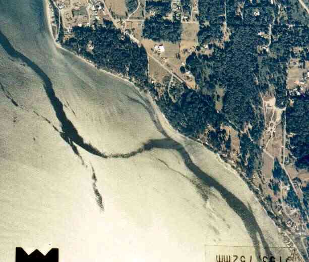
The above September 1997 aerial photo of this section of Camano is from http://www.islandcounty.net/publicworks/digitalphotos/mainmap.htm
The above September 1997 aerial photo of this section of Camano is from
http://www.islandcounty.net/publicworks/digitalphotos/mainmap.htm
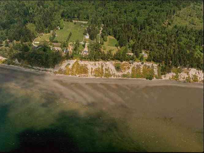
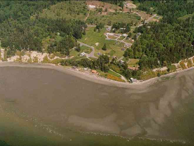
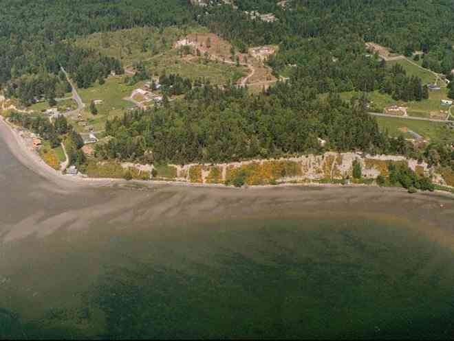
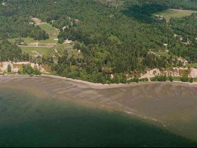
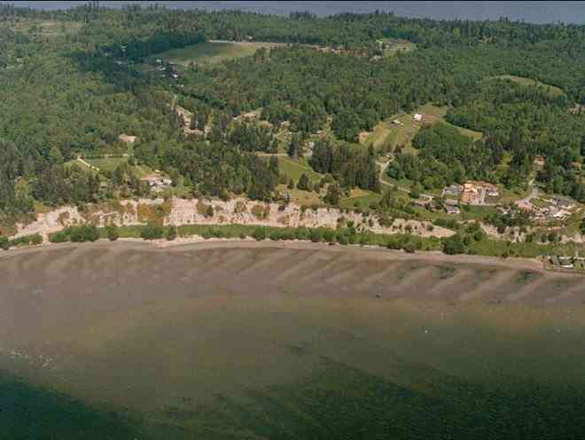
The below 5/11/1993 2:42:00 PM aerial photos are from:
http://apps.ecy.wa.gov/shorephotos
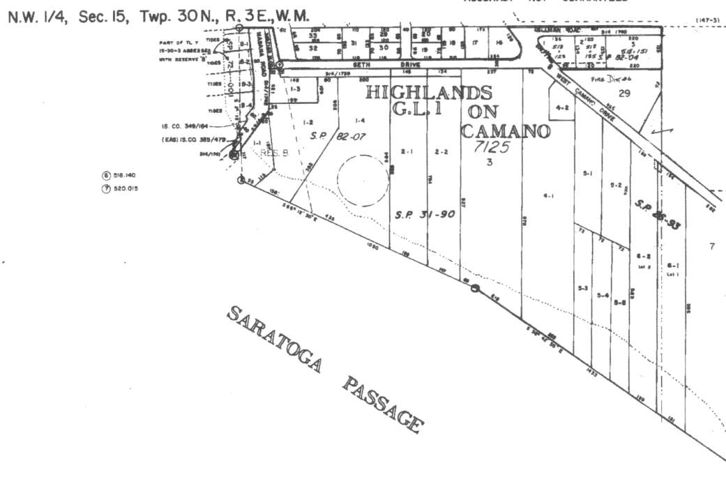
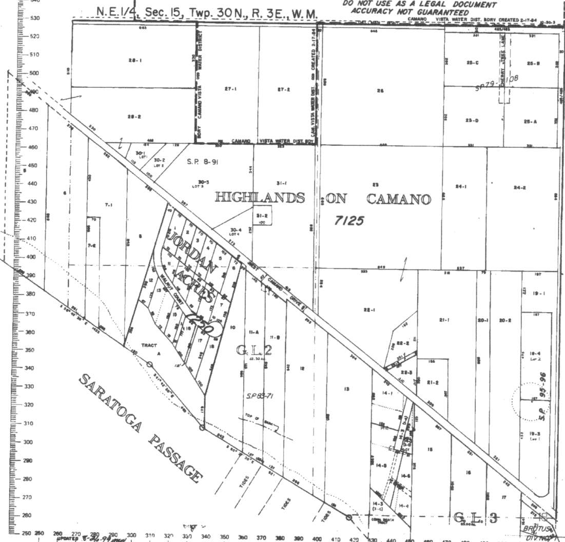
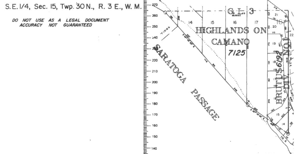
A square system of surveying was ordained by the Continental Congress on May 20, 1785. Within each township (6 miles X 6 miles), are 36 sections. Each section of 640 acres is one mile square (5,280 feet X 5,280 feet). Each quarter section is 160 acres (2,640 feet X 2,640 feet). Most long straight roads and acreage pieces of property have north-south, east-west property lines.
Click on the below Camano section map numbers, to go to a page with Camano Island 2005 assessor data, 1/4 section parcel maps, and aerial photos.
Below are the 11 well reports for this section of Camano, from the December 2004 Washington State Department of Ecology Well log website. Included below is who the well was drilled for, the well depth, and when the well was drilled. At the well log website,
http://apps.ecy.wa.gov/welllog/ more detailed information is available, like the well drillers name, water temperature(sometimes), and soil profile depths.
 <888>
<888>

1. HUNDLEY WAITEĀ - { view PDF
Ā|Ā view TIFF
}
Public Land Survey: NE, NW, S-15, T-30-N, R-03-E, Tax Parcel Number: (blank)
County: ISLAND, Well Address: (blank)
Well Log ID: 79017, Well Tag ID: (blank) , Notice of Intent Number: W075080
Well Diameter: 6 (inches), Well Depth: 230 (feet)
Well Type: Water, Well Completion Date: 12/10/1997, Well Log Received Date: 1/8/1998
2. TERESA GARRISONĀ - { view PDF
Ā|Ā view TIFF
}
Public Land Survey: NE, NE, S-15, T-30-N, R-03-E, Tax Parcel Number: (blank)
County: ISLAND, Well Address: 3246 SW CAMANO DR, CAMANO ISLAND
Well Log ID: 84992, Well Tag ID: (blank) , Notice of Intent Number: A003026
Well Diameter: 36 (inches), Well Depth: 120 (feet)
Well Type: Decommissioned, Well Completion Date: 11/21/1996, Well Log Received Date: 12/4/1996
3. LEONARD HOLDRIDGEĀ - { view PDF
Ā|Ā view TIFF
}
Public Land Survey: SW, NE, S-15, T-30-N, R-03-E, Tax Parcel Number: (blank)
County: ISLAND, Well Address: 1526 DALLMAN RD, CAMANO ISLAND
Well Log ID: 81204, Well Tag ID: (blank) , Notice of Intent Number: (blank)
Well Diameter: 6 (inches), Well Depth: 242 (feet)
Well Type: Water, Well Completion Date: 3/24/1992, Well Log Received Date: 4/1/1992
4. TODD LALONEĀ - { view PDF
Ā|Ā view TIFF
}
Public Land Survey: SE, NE, S-15, T-30-N, R-03-E, Tax Parcel Number: (blank)
County: ISLAND, Well Address: 3247 SW CAMANO DR, CAMANO ISLAND
Well Log ID: 85223, Well Tag ID: (blank) , Notice of Intent Number: 070352
Well Diameter: (blank) , Well Depth: 136 (feet)
Well Type: Water, Well Completion Date: 8/20/1990, Well Log Received Date: (blank)
5. ELAINE WAUGHĀ - { view PDF
Ā|Ā view TIFF
}
Public Land Survey: (blank), (blank), S-15, T-30-N, R-03-E, Tax Parcel Number: (blank)
County: ISLAND, Well Address: 1380 E DAHLMAN RD, CAMANO ISLAND
Well Log ID: 77641, Well Tag ID: (blank) , Notice of Intent Number: (blank)
Well Diameter: 6 (inches), Well Depth: 230 (feet)
Well Type: Water, Well Completion Date: 7/3/1990, Well Log Received Date: (blank)
6. DAVID BROWNĀ - { view PDF
Ā|Ā view TIFF
}
Public Land Survey: (blank), NW, S-15, T-30-N, R-03-E, Tax Parcel Number: (blank)
County: ISLAND, Well Address: CAMANO HIGHLANDS
Well Log ID: 76602, Well Tag ID: (blank) , Notice of Intent Number: 070326
Well Diameter: 6 (inches), Well Depth: 214 (feet)
Well Type: Water, Well Completion Date: 3/2/1990, Well Log Received Date: 3/20/1990
7. ALLEN ROSMANĀ - { view PDF
Ā|Ā view TIFF
}
Public Land Survey: (blank), NW, S-15, T-30-N, R-03-E, Tax Parcel Number: (blank)
County: ISLAND, Well Address: CAMANO ISLAND, 98292
Well Log ID: 74370, Well Tag ID: (blank) , Notice of Intent Number: 070329
Well Diameter: 6 (inches), Well Depth: 185 (feet)
Well Type: Water, Well Completion Date: 2/22/1990, Well Log Received Date: (blank)
8. JOHN SOMMERSĀ - { view PDF
Ā|Ā view TIFF
}
Public Land Survey: NE, NE, S-15, T-30-N, R-03-E, Tax Parcel Number: (blank)
County: ISLAND, Well Address: (blank)
Well Log ID: 80323, Well Tag ID: (blank) , Notice of Intent Number: (blank)
Well Diameter: 6 (inches), Well Depth: 276 (feet)
Well Type: Water, Well Completion Date: 10/17/1983, Well Log Received Date: (blank)
9. POESEHELT SCHULTZRINGĀ - { view PDF
Ā|Ā view TIFF
}
Public Land Survey: NE, NE, S-15, T-30-N, R-03-E, Tax Parcel Number: (blank)
County: ISLAND, Well Address: (blank)
Well Log ID: 83009, Well Tag ID: (blank) , Notice of Intent Number: (blank)
Well Diameter: 6 (inches), Well Depth: 301 (feet)
Well Type: Water, Well Completion Date: 2/10/1980, Well Log Received Date: 10/1/1984
10. JOHN DIEGLEĀ - { view PDF
Ā|Ā view TIFF
}
Public Land Survey: NE, NE, S-15, T-30-N, R-03-E, Tax Parcel Number: (blank)
County: ISLAND, Well Address: 3332 W CAMANO DR, CAMANO ISLAND
Well Log ID: 80112, Well Tag ID: (blank) , Notice of Intent Number: (blank)
Well Diameter: 6 (inches), Well Depth: 195 (feet)
Well Type: Water, Well Completion Date: 6/15/1977, Well Log Received Date: (blank)
11. FIFTEEN INVESTORSĀ - { view PDF
Ā|Ā view TIFF
}
Public Land Survey: NW, NE, S-15, T-30-N, R-03-E, Tax Parcel Number: (blank)
County: ISLAND, Well Address: W CAMANO DR
Well Log ID: 351086, Well Tag ID: AKY745, Notice of Intent Number: (blank)
Well Diameter: 6 (inches), Well Depth: 223 (feet)
Well Type: Water, Well Completion Date: 5/15/1959, Well Log Received Date: (blank)