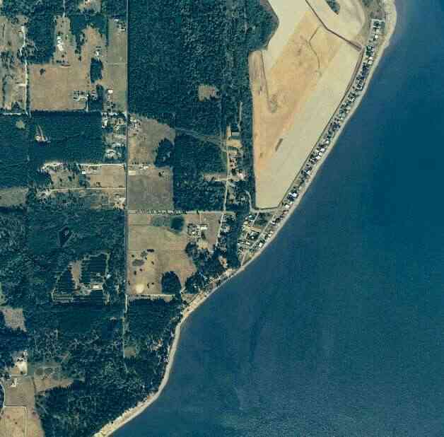
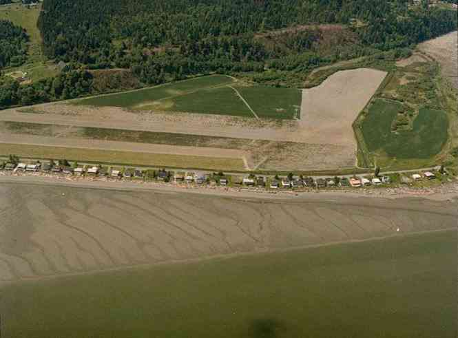
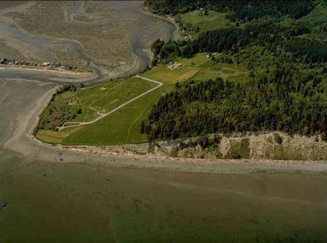
The above September 1997 aerial photo of this section of Camano is from http://www.islandcounty.net/publicworks/digitalphotos/mainmap.htm
The above September 1997 aerial photo of this section of Camano is from
http://www.islandcounty.net/publicworks/digitalphotos/mainmap.htm
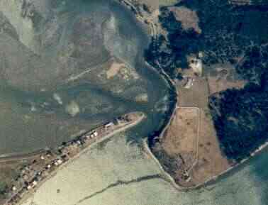
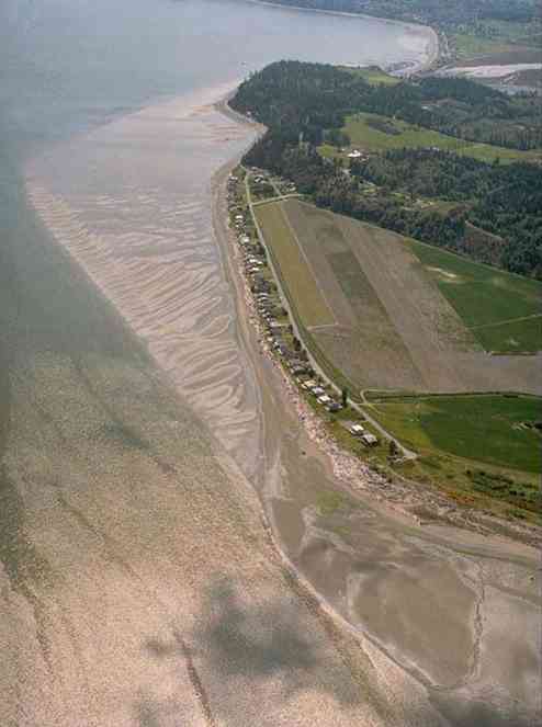
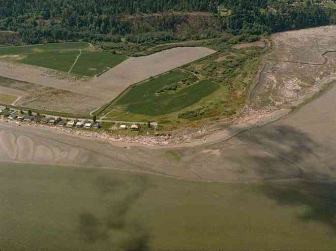
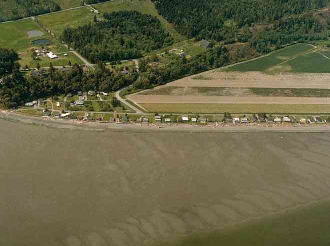
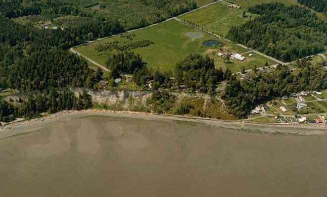
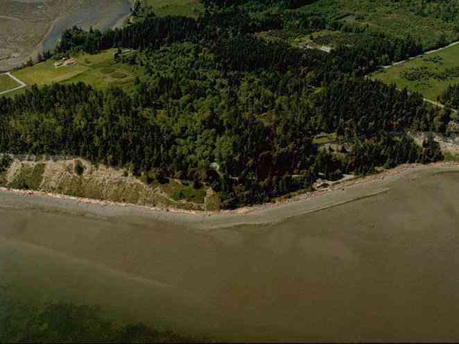
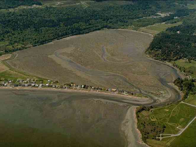
The below 5/11/1993 2:42:00 PM aerial photos are from:
http://apps.ecy.wa.gov/shorephotos
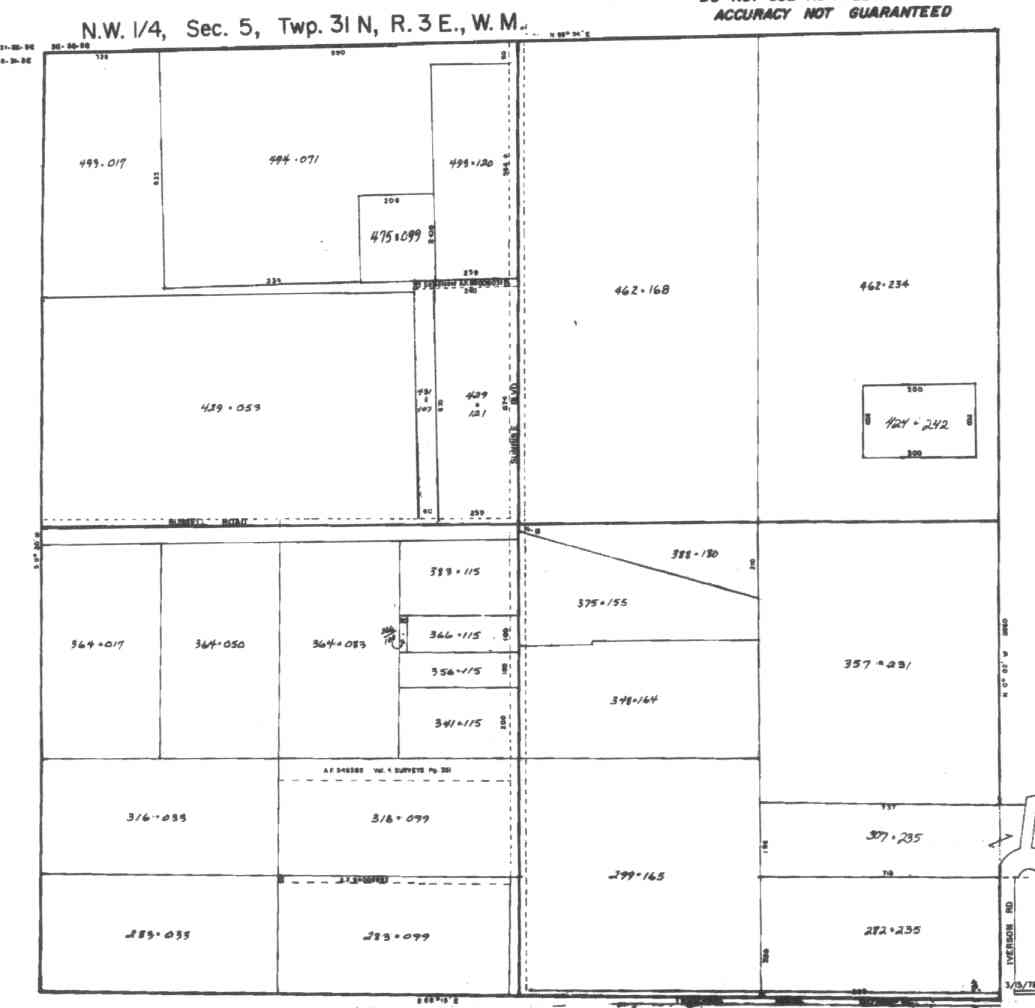
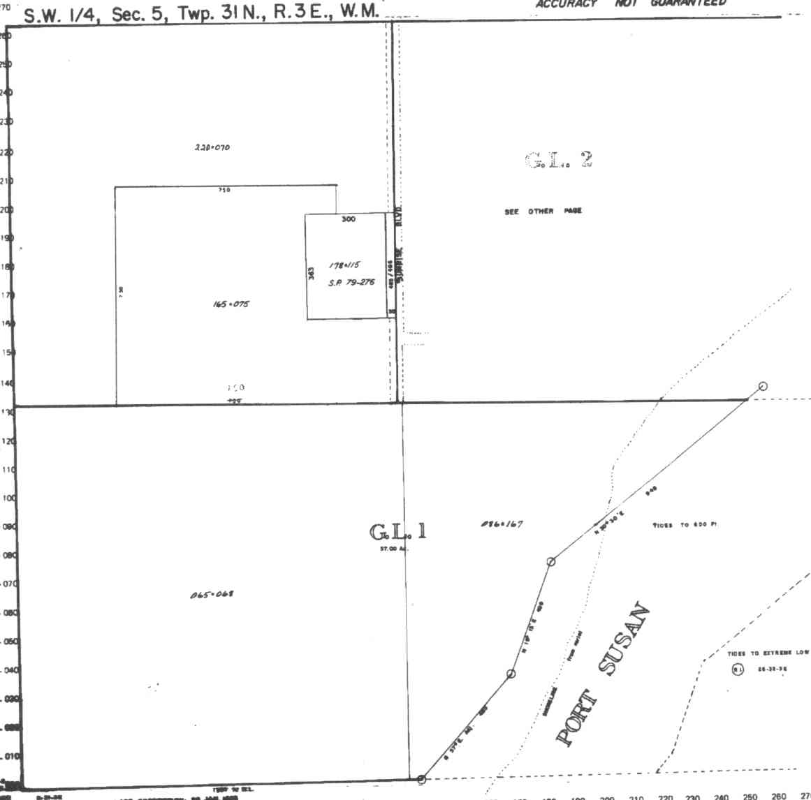
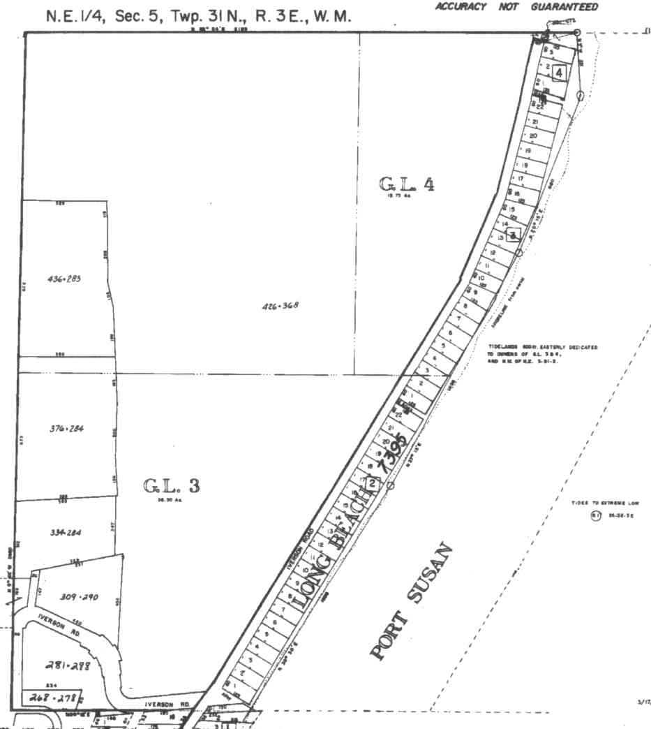
A square system of surveying was ordained by the Continental Congress on May 20, 1785. Within each township (6 miles X 6 miles), are 36 sections. Each section of 640 acres is one mile square (5,280 feet X 5,280 feet). Each quarter section is 160 acres (2,640 feet X 2,640 feet). Most long straight roads and acreage pieces of property have north-south, east-west property lines.
Click on the below Camano section map numbers, to go to a page with Camano Island 2005 assessor data, 1/4 section parcel maps, and aerial photos.
Below are the 26 well reports for this section of Camano, from the December 2004 Washington State Department of Ecology Well log website. Included below is who the well was drilled for, the well depth, and when the well was drilled. At the well log website,
http://apps.ecy.wa.gov/welllog/ more detailed information is available, like the well drillers name, water temperature(sometimes), and soil profile depths.
 <888>
<888>

1. SITEWORKS INCĀ - { view PDF
Ā|Ā view TIFF
}
Public Land Survey: NE, NW, S-05, T-31-N, R-03-E, Tax Parcel Number: R33005-323-1720
County: ISLAND, Well Address: 2415 S CAMANO DR, CAMANO ISLAND 98282
Well Log ID: 389861, Well Tag ID: ABO984, Notice of Intent Number: W175672
Well Diameter: 6 (inches), Well Depth: 201 (feet)
Well Type: Water, Well Completion Date: 7/30/2004, Well Log Received Date: 10/1/2004
2. KINSMAN/HOLZKNECHTĀ - { view PDF
Ā|Ā view TIFF
}
Public Land Survey: NW, NW, S-05, T-31-N, R-03-E, Tax Parcel Number: (blank)
County: ISLAND, Well Address: RUSSELL & SUNRISE
Well Log ID: 359300, Well Tag ID: AHB763, Notice of Intent Number: W153951
Well Diameter: 6 (inches), Well Depth: 239 (feet)
Well Type: Water, Well Completion Date: 4/10/2003, Well Log Received Date: 4/28/2003
3. DEBORAH SCOTTĀ - { view PDF
Ā|Ā view TIFF
}
Public Land Survey: NE, SW, S-05, T-31-N, R-03-E, Tax Parcel Number: (blank)
County: ISLAND, Well Address: XXX MOE RD, CAMANO ISLAND
Well Log ID: 353666, Well Tag ID: AGF422, Notice of Intent Number: W156084
Well Diameter: 6 (inches), Well Depth: 170 (feet)
Well Type: Water, Well Completion Date: 2/7/2003, Well Log Received Date: 2/27/2003
4. PATTY SMALLĀ - { view PDF
Ā|Ā view TIFF
}
Public Land Survey: NE, SW, S-05, T-31-N, R-03-E, Tax Parcel Number: (blank)
County: ISLAND, Well Address: 556 MOE RD, CAMANO ISLAND 98282
Well Log ID: 345326, Well Tag ID: (blank) , Notice of Intent Number: A008985
Well Diameter: 6 (inches), Well Depth: 160 (feet)
Well Type: Decommissioned, Well Completion Date: 10/22/2002, Well Log Received Date: 10/29/2002
5. JUNE IVERSONĀ - { view PDF
Ā|Ā view TIFF
}
Public Land Survey: SW, NE, S-05, T-31-N, R-03-E, Tax Parcel Number: (blank)
County: ISLAND, Well Address: IVERSON BEACH RD, CAMANO ISLAND, 98282
Well Log ID: 314561, Well Tag ID: AFJ791, Notice of Intent Number: W118513
Well Diameter: 6 (inches), Well Depth: 112 (feet)
Well Type: Water, Well Completion Date: 11/2/2001, Well Log Received Date: 11/21/2001
6. JUNE IVERSONĀ - { view PDF
Ā|Ā view TIFF
}
Public Land Survey: SW, NE, S-05, T-31-N, R-03-E, Tax Parcel Number: (blank)
County: ISLAND, Well Address: IVERSON BEACH RD, CAMANO ISLAND, 98282
Well Log ID: 305343, Well Tag ID: AFJ778, Notice of Intent Number: W118512
Well Diameter: 6 (inches), Well Depth: 122 (feet)
Well Type: Water, Well Completion Date: 6/4/2001, Well Log Received Date: 7/12/2001
7. SITEWORKSĀ - { view PDF
Ā|Ā view TIFF
}
Public Land Survey: NE, NW, S-05, T-31-N, R-03-E, Tax Parcel Number: (blank)
County: ISLAND, Well Address: XXX S CAMANO DR, CAMANO ISLAND
Well Log ID: 305301, Well Tag ID: ACY376, Notice of Intent Number: W117785
Well Diameter: 6 (inches), Well Depth: 225 (feet)
Well Type: Water, Well Completion Date: 12/26/2000, Well Log Received Date: 3/1/2001
8. JOHN COMPANIONĀ - { view PDF
Ā|Ā view TIFF
}
Public Land Survey: NW, NE, S-05, T-31-N, R-03-E, Tax Parcel Number: (blank)
County: SKAGIT, Well Address: 13640 BAYVIEW ROAD
Well Log ID: 190033, Well Tag ID: AAX542, Notice of Intent Number: W116485
Well Diameter: 6 (inches), Well Depth: 114 (feet)
Well Type: Water, Well Completion Date: 9/20/1999, Well Log Received Date: 10/5/1999
9. MARY MILLERĀ - { view PDF
Ā|Ā view TIFF
}
Public Land Survey: SE, NW, S-05, T-31-N, R-03-E, Tax Parcel Number: (blank)
County: ISLAND, Well Address: 491 E RUSSELL RD, CAMANO ISLAND
Well Log ID: 81768, Well Tag ID: (blank) , Notice of Intent Number: W094505
Well Diameter: 6 (inches), Well Depth: 211 (feet)
Well Type: Water, Well Completion Date: 3/13/1998, Well Log Received Date: 4/1/1998
10. GENE GONCALVESĀ - { view PDF
Ā|Ā view TIFF
}
Public Land Survey: NW, NW, S-05, T-31-N, R-03-E, Tax Parcel Number: (blank)
County: ISLAND, Well Address: 129 S SUNRISE BLVD, CAMANO ISLAND, 98292
Well Log ID: 78289, Well Tag ID: (blank) , Notice of Intent Number: W073038
Well Diameter: 6 (inches), Well Depth: 215 (feet)
Well Type: Water, Well Completion Date: 9/5/1996, Well Log Received Date: 9/9/1996
11. ED EDITH IVERSONĀ - { view PDF
Ā|Ā view TIFF
}
Public Land Survey: SW, NE, S-05, T-31-N, R-03-E, Tax Parcel Number: (blank)
County: ISLAND, Well Address: 611 E IVERSON RD, CAMANO ISLAND, 98292
Well Log ID: 77505, Well Tag ID: (blank) , Notice of Intent Number: W064588
Well Diameter: 6 (inches), Well Depth: 115 (feet)
Well Type: Water, Well Completion Date: 8/6/1996, Well Log Received Date: 9/9/1996
12. MARK HOLZKNECHTĀ - { view PDF
Ā|Ā view TIFF
}
Public Land Survey: SW, NE, S-05, T-31-N, R-03-E, Tax Parcel Number: (blank)
County: ISLAND, Well Address: 608 E IVERSON RD, CAMANO ISLAND, 98292
Well Log ID: 81629, Well Tag ID: (blank) , Notice of Intent Number: W064586
Well Diameter: 6 (inches), Well Depth: 110 (feet)
Well Type: Water, Well Completion Date: 7/27/1996, Well Log Received Date: 9/9/1996
13. JOHN ORTHĀ - { view PDF
Ā|Ā view TIFF
}
Public Land Survey: SW, NE, S-05, T-31-N, R-03-E, Tax Parcel Number: (blank)
County: ISLAND, Well Address: 609 E IVERSON RD, CAMANO ISLAND, 98292
Well Log ID: 80273, Well Tag ID: (blank) , Notice of Intent Number: W064587
Well Diameter: 6 (inches), Well Depth: 100 (feet)
Well Type: Water, Well Completion Date: 7/22/1996, Well Log Received Date: 9/9/1996
14. LYNDA FLEWERĀ - { view PDF
Ā|Ā view TIFF
}
Public Land Survey: NW, NW, S-05, T-31-N, R-03-E, Tax Parcel Number: (blank)
County: ISLAND, Well Address: S SUNRISE BLVD
Well Log ID: 81452, Well Tag ID: (blank) , Notice of Intent Number: W041510
Well Diameter: 6 (inches), Well Depth: 179 (feet)
Well Type: Water, Well Completion Date: 5/20/1994, Well Log Received Date: 6/6/1994
15. OLE & CANDY ABRAHAMSENĀ - { view PDF
Ā|Ā view TIFF
}
Public Land Survey: NW, NW, S-05, T-31-N, R-03-E, Tax Parcel Number: (blank)
County: ISLAND, Well Address: 397 E RUSSELL RD, CAMANO ISLAND
Well Log ID: 82623, Well Tag ID: (blank) , Notice of Intent Number: W010618
Well Diameter: 6 (inches), Well Depth: 242 (feet)
Well Type: Water, Well Completion Date: 4/14/1994, Well Log Received Date: (blank)
16. RAINIER GROUP LTD.Ā - { view PDF
Ā|Ā view TIFF
}
Public Land Survey: SW, NW, S-05, T-31-N, R-03-E, Tax Parcel Number: (blank)
County: ISLAND, Well Address: (blank)
Well Log ID: 83144, Well Tag ID: (blank) , Notice of Intent Number: W010615
Well Diameter: 6 (inches), Well Depth: 168 (feet)
Well Type: Water, Well Completion Date: 3/15/1994, Well Log Received Date: 3/17/1994
17. STEVE FEHINGĀ - { view PDF
Ā|Ā view TIFF
}
Public Land Survey: SW, NW, S-05, T-31-N, R-03-E, Tax Parcel Number: (blank)
County: ISLAND, Well Address: 406 E RUSSELL RD, CAMANO ISLAND
Well Log ID: 86530, Well Tag ID: ABD911, Notice of Intent Number: W010475
Well Diameter: 6 (inches), Well Depth: 157 (feet)
Well Type: Water, Well Completion Date: 12/9/1993, Well Log Received Date: 12/23/1993
18. RON SOUTHWORTHĀ - { view PDF
Ā|Ā view TIFF
}
Public Land Survey: SW, NW, S-05, T-31-N, R-03-E, Tax Parcel Number: (blank)
County: ISLAND, Well Address: (blank)
Well Log ID: 84074, Well Tag ID: (blank) , Notice of Intent Number: W010606
Well Diameter: 6 (inches), Well Depth: 180 (feet)
Well Type: Water, Well Completion Date: 10/14/1993, Well Log Received Date: 10/19/1993
19. BARRY FLENERĀ - { view PDF
Ā|Ā view TIFF
}
Public Land Survey: SE, NW, S-05, T-31-N, R-03-E, Tax Parcel Number: (blank)
County: ISLAND, Well Address: 150 S SUNRISE, CAMANO ISLAND
Well Log ID: 74633, Well Tag ID: (blank) , Notice of Intent Number: 048523
Well Diameter: 6 (inches), Well Depth: 191 (feet)
Well Type: Water, Well Completion Date: 2/25/1993, Well Log Received Date: (blank)
20. GEORGE MARCHANDĀ - { view PDF
Ā|Ā view TIFF
}
Public Land Survey: NW, NW, S-05, T-31-N, R-03-E, Tax Parcel Number: (blank)
County: ISLAND, Well Address: 438 E LAKE GROVE RD, CAMANO ISLAND, 98292
Well Log ID: 78373, Well Tag ID: (blank) , Notice of Intent Number: 040841
Well Diameter: 6 (inches), Well Depth: 256 (feet)
Well Type: Water, Well Completion Date: 4/25/1991, Well Log Received Date: 5/7/1991
21. SUNRISE POINT WATER CO. C/O MYRON SCOUGALEĀ - { view PDF
Ā|Ā view TIFF
}
Public Land Survey: NE, SW, S-05, T-31-N, R-03-E, Tax Parcel Number: (blank)
County: ISLAND, Well Address: S MOE RD
Well Log ID: 84885, Well Tag ID: AGA706, Notice of Intent Number: (blank)
Well Diameter: 6 (inches), Well Depth: 171 (feet)
Well Type: Water, Well Completion Date: 9/30/1987, Well Log Received Date: 10/9/1987
22. BERRY FLEMERĀ - { view PDF
Ā|Ā view TIFF
}
Public Land Survey: SE, NW, S-05, T-31-N, R-03-E, Tax Parcel Number: (blank)
County: ISLAND, Well Address: (blank)
Well Log ID: 74729, Well Tag ID: (blank) , Notice of Intent Number: (blank)
Well Diameter: 6 (inches), Well Depth: 178 (feet)
Well Type: Water, Well Completion Date: 1/18/1985, Well Log Received Date: (blank)
23. DON PARRISHĀ - { view PDF
Ā|Ā view TIFF
}
Public Land Survey: NW, NW, S-05, T-31-N, R-03-E, Tax Parcel Number: (blank)
County: ISLAND, Well Address: (blank)
Well Log ID: 77121, Well Tag ID: (blank) , Notice of Intent Number: (blank)
Well Diameter: 6 (inches), Well Depth: 145 (feet)
Well Type: Water, Well Completion Date: 11/29/1978, Well Log Received Date: (blank)
24. SUNRISE POINT WATER COĀ - { view PDF
Ā|Ā view TIFF
}
Public Land Survey: NE, SW, S-05, T-31-N, R-03-E, Tax Parcel Number: (blank)
County: ISLAND, Well Address: (blank)
Well Log ID: 351116, Well Tag ID: (blank) , Notice of Intent Number: (blank)
Well Diameter: 6 (inches), Well Depth: 169 (feet)
Well Type: Water, Well Completion Date: 5/16/1969, Well Log Received Date: (blank)
25. LONG BEACH WATER DISTRICTĀ - { view PDF
Ā|Ā view TIFF
}
Public Land Survey: NE, NW, S-05, T-31-N, R-03-E, Tax Parcel Number: (blank)
County: ISLAND, Well Address: (blank)
Well Log ID: 351115, Well Tag ID: (blank) , Notice of Intent Number: (blank)
Well Diameter: 8 (inches), Well Depth: 178 (feet)
Well Type: Water, Well Completion Date: 10/9/1968, Well Log Received Date: (blank)
26. ROBERT S FULLERTONĀ - { view PDF
Ā|Ā view TIFF
}
Public Land Survey: SW, NW, S-05, T-31-N, R-03-E, Tax Parcel Number: (blank)
County: ISLAND, Well Address: (blank)
Well Log ID: 351117, Well Tag ID: (blank) , Notice of Intent Number: (blank)
Well Diameter: 6 (inches), Well Depth: 176 (feet)
Well Type: Water, Well Completion Date: 10/31/1958, Well Log Received Date: (blank)