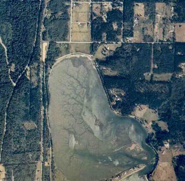
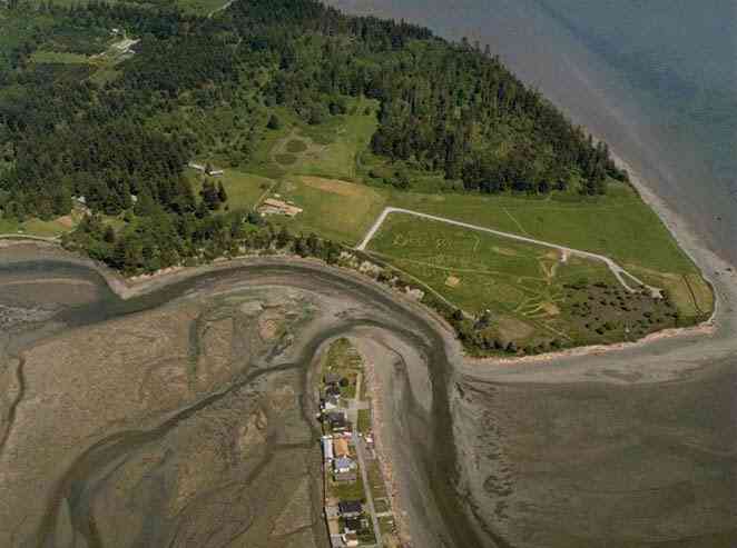
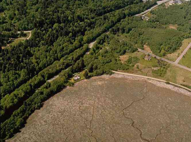
The above September 1997 aerial photo of this section of Camano is from http://www.islandcounty.net/publicworks/digitalphotos/mainmap.htm
The above September 1997 aerial photo of this section of Camano is from
http://www.islandcounty.net/publicworks/digitalphotos/mainmap.htm
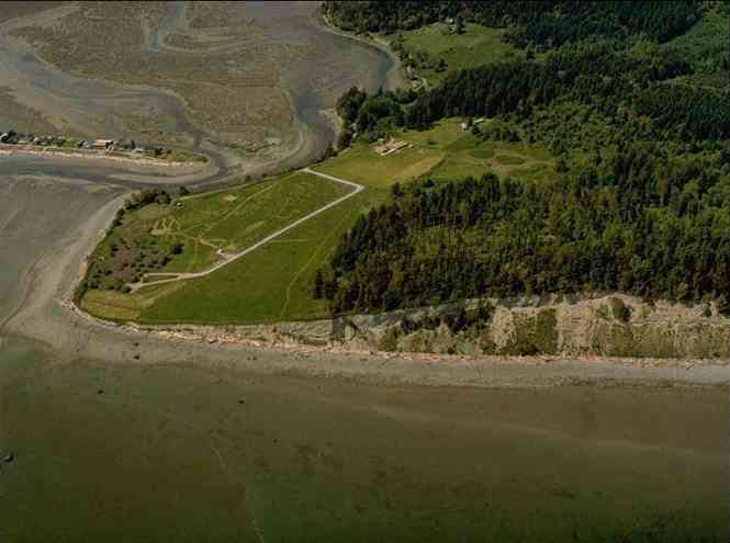
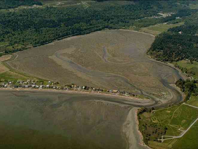
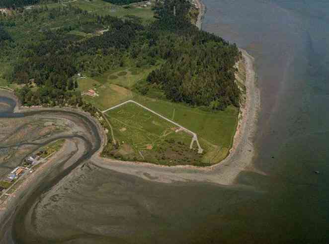
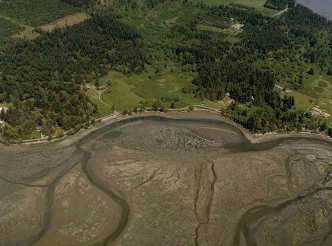
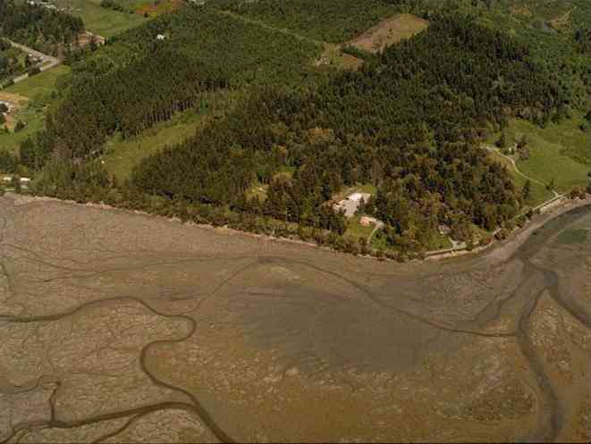
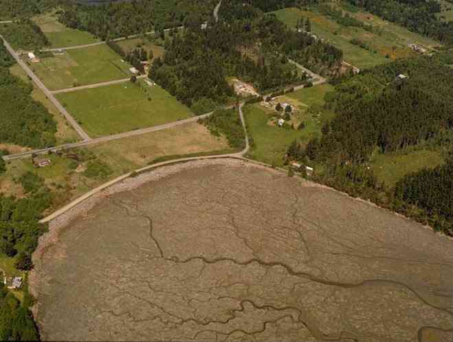
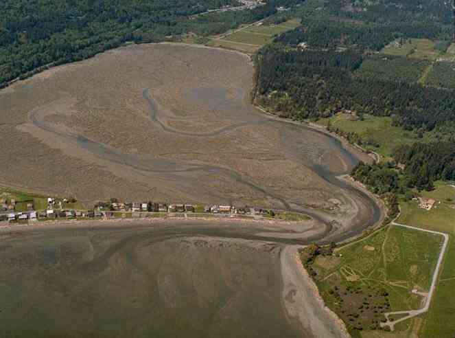
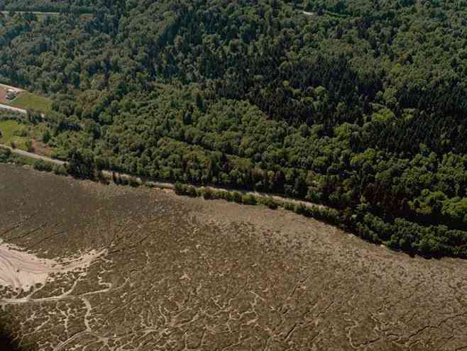
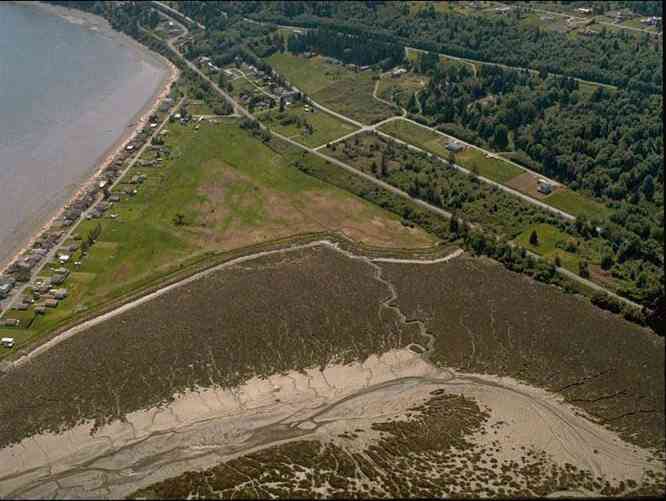
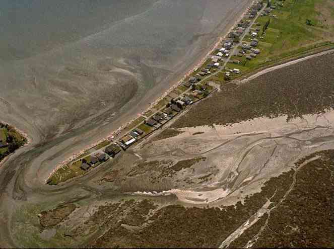
The below 5/11/1993 2:42:00 PM aerial photos are from:
http://apps.ecy.wa.gov/shorephotos
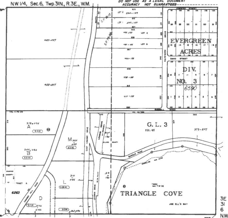
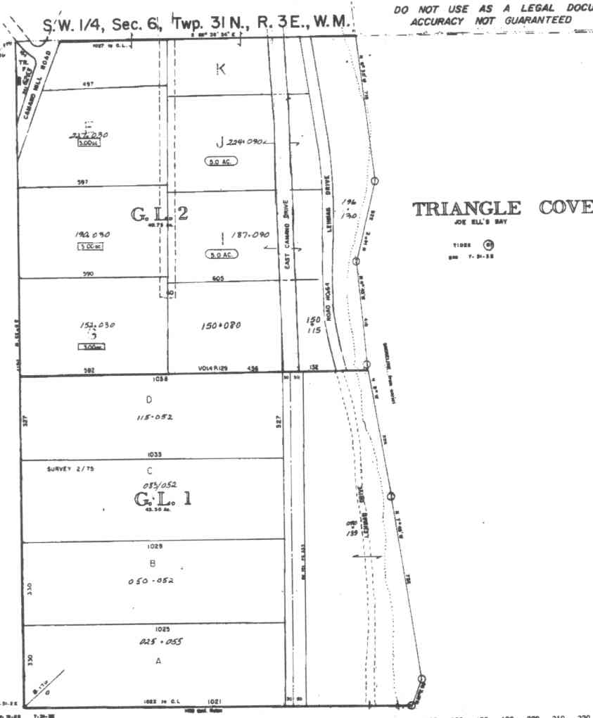
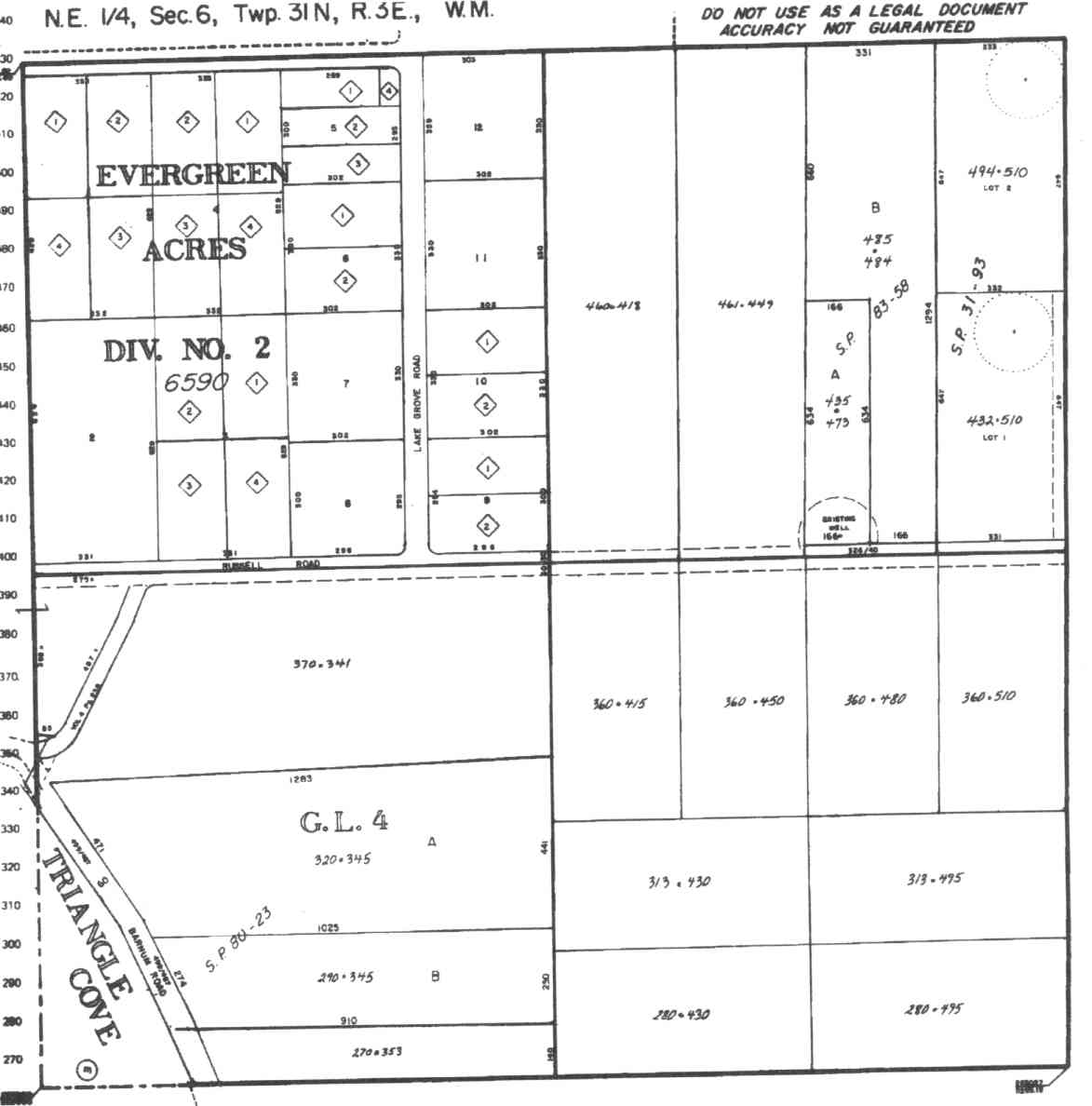
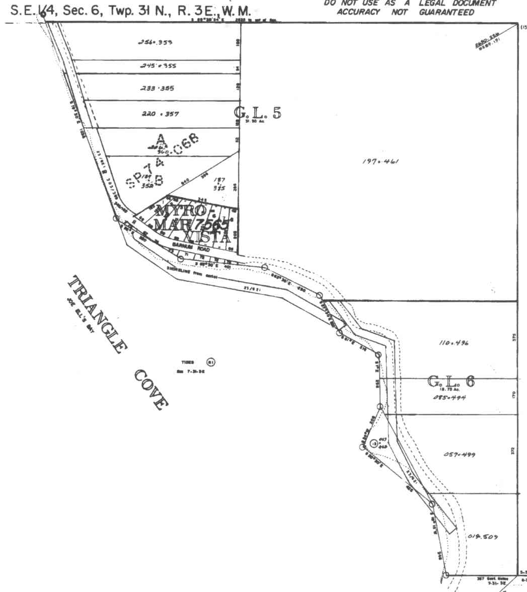
A square system of surveying was ordained by the Continental Congress on May 20, 1785. Within each township (6 miles X 6 miles), are 36 sections. Each section of 640 acres is one mile square (5,280 feet X 5,280 feet). Each quarter section is 160 acres (2,640 feet X 2,640 feet). Most long straight roads and acreage pieces of property have north-south, east-west property lines.
Click on the below Camano section map numbers, to go to a page with Camano Island 2005 assessor data, 1/4 section parcel maps, and aerial photos.
Below are the 26 well reports for this section of Camano, from the December 2004 Washington State Department of Ecology Well log website. Included below is who the well was drilled for, the well depth, and when the well was drilled. At the well log website,
http://apps.ecy.wa.gov/welllog/ more detailed information is available, like the well drillers name, water temperature(sometimes), and soil profile depths.
 <888>
<888>

1. KEN LUNDGRIGANĀ - { view PDF
Ā|Ā view TIFF
}
Public Land Survey: SW, NW, S-06, T-31-N, R-03-E, Tax Parcel Number: R33106-344-0320
County: ISLAND, Well Address: 160 CAMANO HILL RD, CAMANO ISLAND 98282
Well Log ID: 383110, Well Tag ID: ABO977, Notice of Intent Number: W175660
Well Diameter: 6 (inches), Well Depth: 196 (feet)
Well Type: Water, Well Completion Date: 6/3/2004, Well Log Received Date: 7/21/2004
2. JERRY NIELSENĀ - { view PDF
Ā|Ā view TIFF
}
Public Land Survey: NW, SE, S-06, T-31-N, R-03-E, Tax Parcel Number: (blank)
County: ISLAND, Well Address: 219 BARNUM RD, CAMANO ISLAND
Well Log ID: 379646, Well Tag ID: AGK767, Notice of Intent Number: W120945
Well Diameter: 6 (inches), Well Depth: 119 (feet)
Well Type: Water, Well Completion Date: 4/25/2004, Well Log Received Date: 5/18/2004
3. ALAN-DIANE KINCHĀ - { view PDF
Ā|Ā view TIFF
}
Public Land Survey: SW, NW, S-06, T-31-N, R-03-E, Tax Parcel Number: R33106-378-0350
County: ISLAND, Well Address: 140 CAMNO HILL RD, CAMANO ISLAND 98282
Well Log ID: 372876, Well Tag ID: ABO962, Notice of Intent Number: W153741
Well Diameter: 6 (inches), Well Depth: 173 (feet)
Well Type: Water, Well Completion Date: 12/18/2003, Well Log Received Date: 12/31/2003
4. WELSEY ZOLLERĀ - { view PDF
Ā|Ā view TIFF
}
Public Land Survey: SW, NW, S-06, T-31-N, R-03-E, Tax Parcel Number: (blank)
County: ISLAND, Well Address: E CAMANO DR, CAMANO ISLAND
Well Log ID: 368248, Well Tag ID: AKY925, Notice of Intent Number: W153995
Well Diameter: 6 (inches), Well Depth: 143 (feet)
Well Type: Water, Well Completion Date: 8/12/2003, Well Log Received Date: 9/2/2003
5. TRAVIS KOSTERĀ - { view PDF
Ā|Ā view TIFF
}
Public Land Survey: SE, NE, S-06, T-31-N, R-03-E, Tax Parcel Number: R33106-360-4500
County: ISLAND, Well Address: 320 RUSSEL RD, CAMANO, 98292
Well Log ID: 359608, Well Tag ID: ABO936, Notice of Intent Number: W153719
Well Diameter: 6 (inches), Well Depth: 160 (feet)
Well Type: Water, Well Completion Date: 3/13/2003, Well Log Received Date: 5/9/2003
6. GARY SWENSONĀ - { view PDF
Ā|Ā view TIFF
}
Public Land Survey: NW, NE, S-06, T-31-N, R-03-E, Tax Parcel Number: (blank)
County: ISLAND, Well Address: 84 S LAKE GROVE RD, CAMANO ISLAND
Well Log ID: 305302, Well Tag ID: AFJ491, Notice of Intent Number: W112677
Well Diameter: 6 (inches), Well Depth: 214 (feet)
Well Type: Water, Well Completion Date: 4/9/2001, Well Log Received Date: 4/19/2001
7. RONALD J. WELLSĀ - { view PDF
Ā|Ā view TIFF
}
Public Land Survey: SW, NW, S-06, T-31-N, R-03-E, Tax Parcel Number: (blank)
County: ISLAND, Well Address: 175 TRIANGLE COVE LANE, CAMANO ISLAND, WA
Well Log ID: 248141, Well Tag ID: ABD736, Notice of Intent Number: W098070
Well Diameter: 6 (inches), Well Depth: 112 (feet)
Well Type: Water, Well Completion Date: 12/22/1999, Well Log Received Date: 1/11/2000
8. ROBERT FULLERTONĀ - { view PDF
Ā|Ā view TIFF
}
Public Land Survey: SE, NE, S-06, T-31-N, R-03-E, Tax Parcel Number: (blank)
County: ISLAND, Well Address: 396 RUSSELL RD, CAMANO ISLAND
Well Log ID: 190069, Well Tag ID: ABD013, Notice of Intent Number: 120051
Well Diameter: 6 (inches), Well Depth: 198 (feet)
Well Type: Water, Well Completion Date: 7/8/1999, Well Log Received Date: 8/16/1999
9. BRUCE LITTLEJOHN - COACH CORRALĀ - { view PDF
Ā|Ā view TIFF
}
Public Land Survey: NW, NE, S-06, T-31-N, R-03-E, Tax Parcel Number: (blank)
County: ISLAND, Well Address: LAKE GROVE RD, CAMANO ISLAND
Well Log ID: 190671, Well Tag ID: AES594, Notice of Intent Number: W110165
Well Diameter: 6 (inches), Well Depth: 138 (feet)
Well Type: Water, Well Completion Date: 6/30/1999, Well Log Received Date: 7/15/1999
10. BARRY FLENERĀ - { view PDF
Ā|Ā view TIFF
}
Public Land Survey: SE, NE, S-06, T-31-N, R-03-E, Tax Parcel Number: (blank)
County: ISLAND, Well Address: (blank)
Well Log ID: 87647, Well Tag ID: AEP061, Notice of Intent Number: W108071
Well Diameter: 6 (inches), Well Depth: 160 (feet)
Well Type: Water, Well Completion Date: 10/15/1998, Well Log Received Date: 11/4/1998
11. PETER MAURERĀ - { view PDF
Ā|Ā view TIFF
}
Public Land Survey: SW, NE, S-06, T-31-N, R-03-E, Tax Parcel Number: (blank)
County: ISLAND, Well Address: 173 S BARUND RD, CAMANO ISLAND, 98292
Well Log ID: 87455, Well Tag ID: ACY732, Notice of Intent Number: W104152
Well Diameter: 6 (inches), Well Depth: 119 (feet)
Well Type: Water, Well Completion Date: 9/28/1998, Well Log Received Date: 10/1/1998
12. BARRY FLENERĀ - { view PDF
Ā|Ā view TIFF
}
Public Land Survey: NE, SE, S-06, T-31-N, R-03-E, Tax Parcel Number: (blank)
County: ISLAND, Well Address: N HAMSTEAD
Well Log ID: 74634, Well Tag ID: (blank) , Notice of Intent Number: W104247
Well Diameter: 6 (inches), Well Depth: 158 (feet)
Well Type: Water, Well Completion Date: 9/10/1998, Well Log Received Date: 9/24/1998
13. BARRY FLENNERĀ - { view PDF
Ā|Ā view TIFF
}
Public Land Survey: NE, NW, S-06, T-31-N, R-03-E, Tax Parcel Number: (blank)
County: ISLAND, Well Address: KAWATEE RD
Well Log ID: 74635, Well Tag ID: (blank) , Notice of Intent Number: W072327
Well Diameter: 6 (inches), Well Depth: 125 (feet)
Well Type: Water, Well Completion Date: 7/25/1996, Well Log Received Date: 8/16/1996
14. JOHN DUSTINĀ - { view PDF
Ā|Ā view TIFF
}
Public Land Survey: NE, NE, S-06, T-31-N, R-03-E, Tax Parcel Number: (blank)
County: ISLAND, Well Address: 395 RUSSELL RD, CAMANO ISLAND, 98292
Well Log ID: 80119, Well Tag ID: (blank) , Notice of Intent Number: W054353
Well Diameter: 6 (inches), Well Depth: 220 (feet)
Well Type: Water, Well Completion Date: 5/1/1996, Well Log Received Date: 5/24/1996
15. Driftwood ShoresĀ - { view PDF
Ā|Ā view TIFF
}
Public Land Survey: SW, SW, S-06, T-31-N, R-03-E, Tax Parcel Number: (blank)
County: ISLAND, Well Address: 600 Camano Hill
Well Log ID: 86972, Well Tag ID: AGA710, Notice of Intent Number: W065141
Well Diameter: 8 (inches), Well Depth: 460 (feet)
Well Type: Water, Well Completion Date: 2/26/1996, Well Log Received Date: 3/21/1996
16. DAVE MARROWĀ - { view PDF
Ā|Ā view TIFF
}
Public Land Survey: NE, SE, S-06, T-31-N, R-03-E, Tax Parcel Number: (blank)
County: ISLAND, Well Address: 390 LEHMAN DR, CAMANO ISLAND
Well Log ID: 76509, Well Tag ID: (blank) , Notice of Intent Number: W041900
Well Diameter: 6 (inches), Well Depth: 210 (feet)
Well Type: Water, Well Completion Date: 7/22/1994, Well Log Received Date: 8/15/1994
17. JOHN NOSTEĀ - { view PDF
Ā|Ā view TIFF
}
Public Land Survey: SE, NE, S-06, T-31-N, R-03-E, Tax Parcel Number: (blank)
County: ISLAND, Well Address: RUSSELL RD, CAMANO ISLAND, 98292
Well Log ID: 80265, Well Tag ID: (blank) , Notice of Intent Number: 010555
Well Diameter: 6 (inches), Well Depth: 220 (feet)
Well Type: Water, Well Completion Date: 11/19/1993, Well Log Received Date: 1/27/1994
18. TED YASINĀ - { view PDF
Ā|Ā view TIFF
}
Public Land Survey: NE, NE, S-06, T-31-N, R-03-E, Tax Parcel Number: (blank)
County: ISLAND, Well Address: (blank)
Well Log ID: 84985, Well Tag ID: (blank) , Notice of Intent Number: W010607
Well Diameter: 6 (inches), Well Depth: 168 (feet)
Well Type: Water, Well Completion Date: 10/27/1993, Well Log Received Date: 11/29/1993
19. VASILE HAPAIANUĀ - { view PDF
Ā|Ā view TIFF
}
Public Land Survey: NE, NE, S-06, T-31-N, R-03-E, Tax Parcel Number: (blank)
County: ISLAND, Well Address: (blank)
Well Log ID: 85488, Well Tag ID: (blank) , Notice of Intent Number: W010603
Well Diameter: 6 (inches), Well Depth: 175 (feet)
Well Type: Water, Well Completion Date: 10/8/1993, Well Log Received Date: 10/19/1993
20. GARY HONOUSEKĀ - { view PDF
Ā|Ā view TIFF
}
Public Land Survey: SW, NW, S-06, T-31-N, R-03-E, Tax Parcel Number: (blank)
County: ISLAND, Well Address: 354 LAKE GROVE RD, CAMANO ISLAND
Well Log ID: 78196, Well Tag ID: (blank) , Notice of Intent Number: (blank)
Well Diameter: 6 (inches), Well Depth: 193 (feet)
Well Type: Water, Well Completion Date: 10/6/1992, Well Log Received Date: (blank)
21. GRANT LAWRENCEĀ - { view PDF
Ā|Ā view TIFF
}
Public Land Survey: NE, NE, S-06, T-31-N, R-03-E, Tax Parcel Number: (blank)
County: ISLAND, Well Address: 359 E RUSSELL RD, CAMANO ISLAND, 98292
Well Log ID: 78600, Well Tag ID: (blank) , Notice of Intent Number: 040881
Well Diameter: 6 (inches), Well Depth: 206 (feet)
Well Type: Water, Well Completion Date: 9/6/1991, Well Log Received Date: 10/1/1991
22. GTE NORTHWESTĀ - { view PDF
Ā|Ā view TIFF
}
Public Land Survey: NW, NW, S-06, T-31-N, R-03-E, Tax Parcel Number: (blank)
County: ISLAND, Well Address: RUSSELL AND SUNRISE, CAMANO ISLAND
Well Log ID: 78684, Well Tag ID: (blank) , Notice of Intent Number: (blank)
Well Diameter: 6 (inches), Well Depth: 200 (feet)
Well Type: Water, Well Completion Date: 6/4/1990, Well Log Received Date: 6/29/1990
23. MKE DUROVACHECĀ - { view PDF
Ā|Ā view TIFF
}
Public Land Survey: SE, NW, S-06, T-31-N, R-03-E, Tax Parcel Number: (blank)
County: ISLAND, Well Address: (blank)
Well Log ID: 82228, Well Tag ID: (blank) , Notice of Intent Number: (blank)
Well Diameter: 6 (inches), Well Depth: 180 (feet)
Well Type: Water, Well Completion Date: 6/22/1988, Well Log Received Date: (blank)
24. DON ANGELĀ - { view PDF
Ā|Ā view TIFF
}
Public Land Survey: SW, NW, S-06, T-31-N, R-03-E, Tax Parcel Number: (blank)
County: ISLAND, Well Address: (blank)
Well Log ID: 77035, Well Tag ID: (blank) , Notice of Intent Number: 015212
Well Diameter: 6 (inches), Well Depth: 480 (feet)
Well Type: Water, Well Completion Date: 3/23/1988, Well Log Received Date: (blank)
25. OLYĀ - { view PDF
Ā|Ā view TIFF
}
Public Land Survey: NW, NW, S-06, T-31-N, R-03-E, Tax Parcel Number: (blank)
County: ISLAND, Well Address: (blank)
Well Log ID: 82630, Well Tag ID: (blank) , Notice of Intent Number: (blank)
Well Diameter: 36 (inches), Well Depth: 30 (feet)
Well Type: Water, Well Completion Date: 8/8/1986, Well Log Received Date: (blank)
26. JEAN ANDERSONĀ - { view PDF
Ā|Ā view TIFF
}
Public Land Survey: NE, NE, S-06, T-31-N, R-03-E, Tax Parcel Number: (blank)
County: ISLAND, Well Address: (blank)
Well Log ID: 79434, Well Tag ID: (blank) , Notice of Intent Number: (blank)
Well Diameter: 6 (inches), Well Depth: 260 (feet)
Well Type: Water, Well Completion Date: 4/3/1979, Well Log Received Date: (blank)