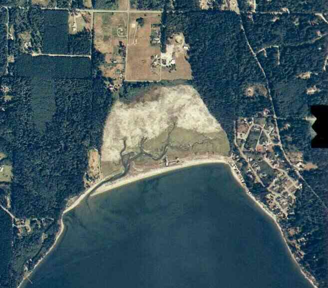
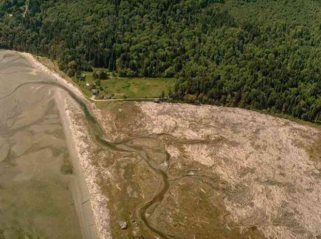
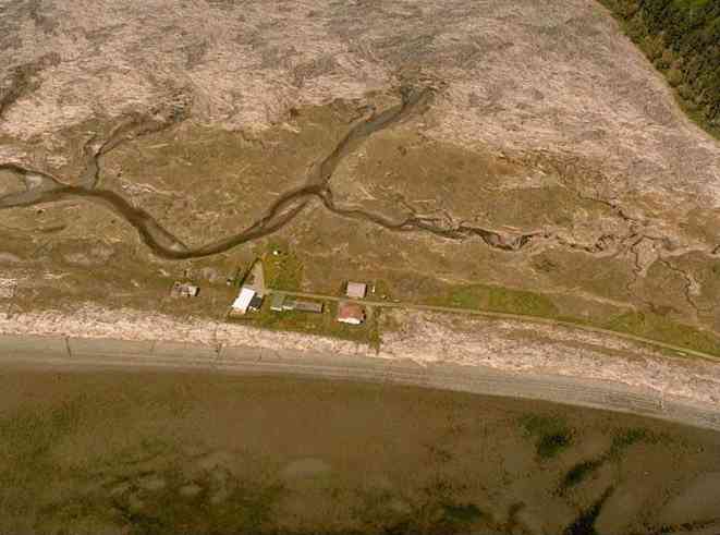
The above September 1997 aerial photo of this section of Camano is from http://www.islandcounty.net/publicworks/digitalphotos/mainmap.htm
The above September 1997 aerial photo of this section of Camano is from
http://www.islandcounty.net/publicworks/digitalphotos/mainmap.htm
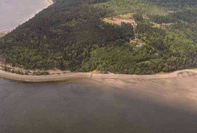
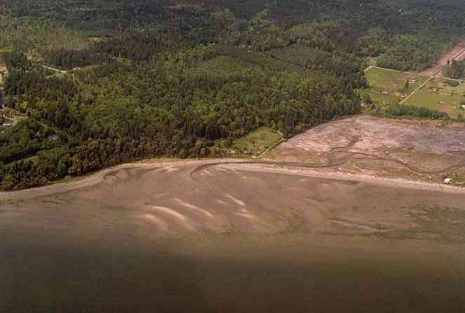
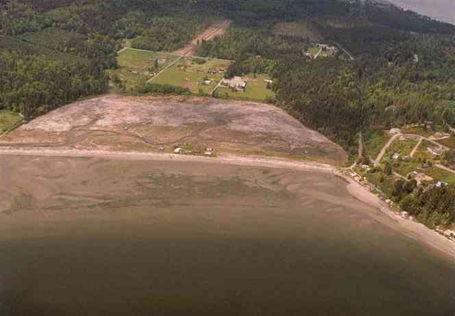
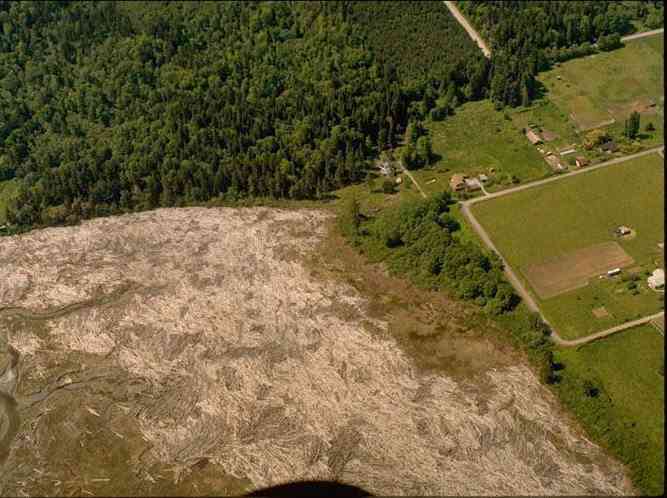
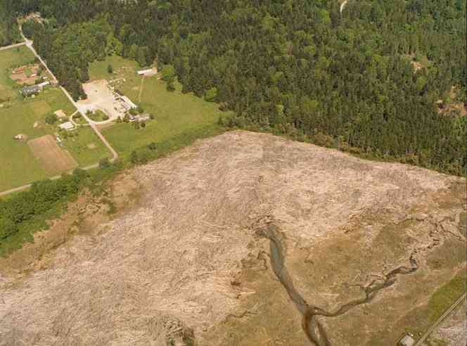
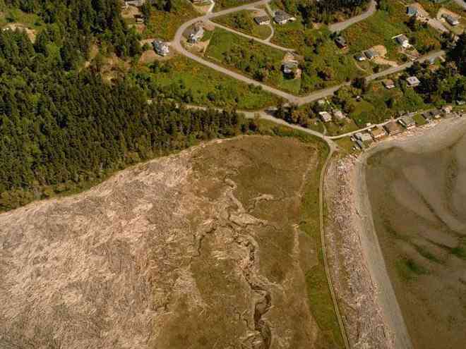
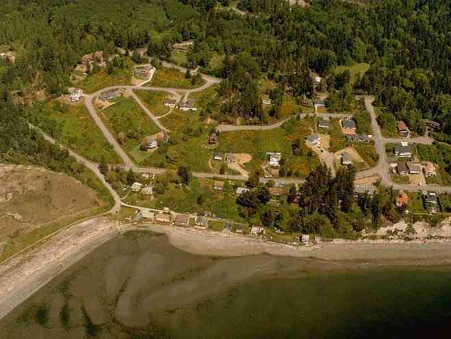
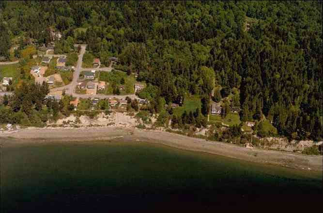
The below 5/8/1993 2:30:00 PM and 5/11/1993 1:42:00 PM aerial photos are from:
http://apps.ecy.wa.gov/shorephotos
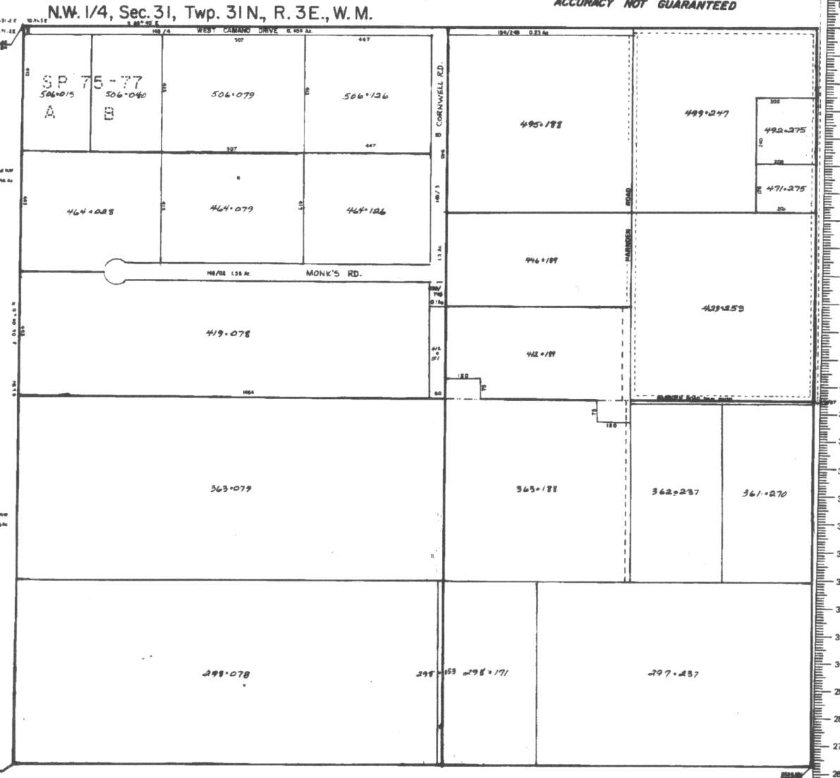
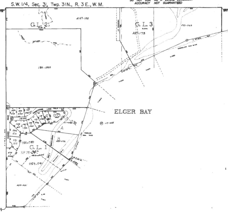
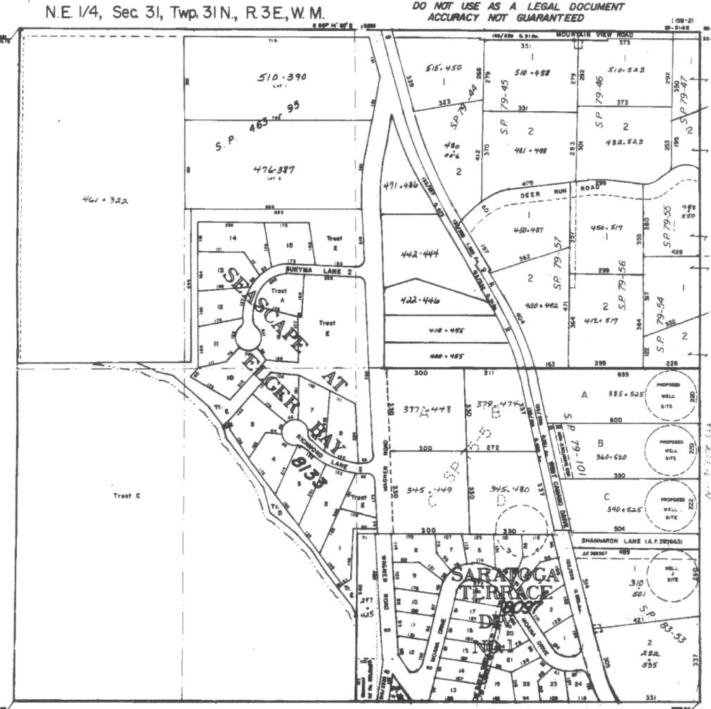
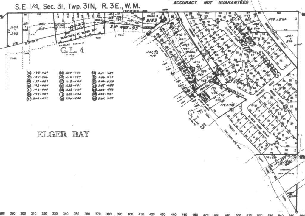
A square system of surveying was ordained by the Continental Congress on May 20, 1785. Within each township (6 miles X 6 miles), are 36 sections. Each section of 640 acres is one mile square (5,280 feet X 5,280 feet). Each quarter section is 160 acres (2,640 feet X 2,640 feet). Most long straight roads and acreage pieces of property have north-south, east-west property lines.
Click on the below Camano section map numbers, to go to a page with Camano Island 2005 assessor data, 1/4 section parcel maps, and aerial photos.
Below are the 23 well reports for this section of Camano, from the December 2004 Washington State Department of Ecology Well log website. Included below is who the well was drilled for, the well depth, and when the well was drilled. At the well log website,
http://apps.ecy.wa.gov/welllog/ more detailed information is available, like the well drillers name, water temperature(sometimes), and soil profile depths.
 <888>
<888>

1. TOM SPANGLER / ROSVALLĀ - { view PDF
Ā|Ā view TIFF
}
Public Land Survey: NW, SE, S-31, T-31-N, R-03-E, Tax Parcel Number: (blank)
County: SNOHOMISH, Well Address: 9233 EVERGREEN WY, STANWOOD
Well Log ID: 391539, Well Tag ID: AHT497, Notice of Intent Number: W182218
Well Diameter: 6 (inches), Well Depth: 378.5 (feet)
Well Type: Water, Well Completion Date: 8/6/2004, Well Log Received Date: 9/14/2004
2. JOHN DEELYĀ - { view PDF
Ā|Ā view TIFF
}
Public Land Survey: SE, NW, S-31, T-31-N, R-03-E, Tax Parcel Number: R33131-298-1710
County: ISLAND, Well Address: 22XX SHERVIN RD, CAMANO ISLAND, 98282
Well Log ID: 364436, Well Tag ID: ABO946, Notice of Intent Number: W153727
Well Diameter: 6 (inches), Well Depth: 63 (feet)
Well Type: Water, Well Completion Date: 6/13/2003, Well Log Received Date: 7/2/2003
3. ART AXELSONĀ - { view PDF
Ā|Ā view TIFF
}
Public Land Survey: SW, SW, S-31, T-31-N, R-03-E, Tax Parcel Number: (blank)
County: CLALLAM, Well Address: EBERLY RD
Well Log ID: 388608, Well Tag ID: AHM329, Notice of Intent Number: W135496
Well Diameter: 6 (inches), Well Depth: 94 (feet)
Well Type: Water, Well Completion Date: 6/2/2003, Well Log Received Date: 10/6/2004
4. JUNE DELLWINGĀ - { view PDF
Ā|Ā view TIFF
}
Public Land Survey: NE, NE, S-31, T-31-N, R-03-E, Tax Parcel Number: 4946-003-003-03
County: SNOHOMISH, Well Address: 824 150 NE ARLINGTON 98323
Well Log ID: 330031, Well Tag ID: AFR095, Notice of Intent Number: W150877
Well Diameter: 6 (inches), Well Depth: 103 (feet)
Well Type: Water, Well Completion Date: 1/23/2002, Well Log Received Date: 2/20/2002
5. KENNETH RAMAGEĀ - { view PDF
Ā|Ā view TIFF
}
Public Land Survey: SE, NE, S-31, T-31-N, R-03-E, Tax Parcel Number: (blank)
County: ISLAND, Well Address: 2185 CAMANO DR, CAMANO ISLAND, 98292
Well Log ID: 314569, Well Tag ID: AGK722, Notice of Intent Number: W120967
Well Diameter: 6 (inches), Well Depth: 300 (feet)
Well Type: Water, Well Completion Date: 11/9/2001, Well Log Received Date: 11/19/2001
6. SUN MOUNTAIN CONST.Ā - { view PDF
Ā|Ā view TIFF
}
Public Land Survey: NW, NW, S-31, T-31-N, R-03-E, Tax Parcel Number: (blank)
County: ISLAND, Well Address: MT. VIEW ROAD, CAMANO ISLAND
Well Log ID: 248144, Well Tag ID: ABD023, Notice of Intent Number: (blank)
Well Diameter: 6 (inches), Well Depth: 237 (feet)
Well Type: Water, Well Completion Date: 12/8/1999, Well Log Received Date: 2/3/2000
7. DAVE PARKERĀ - { view PDF
Ā|Ā view TIFF
}
Public Land Survey: NW, NW, S-31, T-31-N, R-03-E, Tax Parcel Number: (blank)
County: ISLAND, Well Address: MTN VIEW RD AND FIRWOOD
Well Log ID: 190491, Well Tag ID: AEM112, Notice of Intent Number: W106684
Well Diameter: 6 (inches), Well Depth: 283 (feet)
Well Type: Water, Well Completion Date: 4/15/1999, Well Log Received Date: 6/18/1999
8. MARTIN DAYĀ - { view PDF
Ā|Ā view TIFF
}
Public Land Survey: NE, NE, S-31, T-31-N, R-03-E, Tax Parcel Number: (blank)
County: ISLAND, Well Address: 20096 WAGNER RD
Well Log ID: 81695, Well Tag ID: (blank) , Notice of Intent Number: W104140
Well Diameter: 6 (inches), Well Depth: 165 (feet)
Well Type: Water, Well Completion Date: 7/6/1998, Well Log Received Date: 7/14/1998
9. CAMANO PLAZA / JOHN CARTHĀ - { view PDF
Ā|Ā view TIFF
}
Public Land Survey: SW, NE, S-31, T-31-N, R-03-E, Tax Parcel Number: (blank)
County: ISLAND, Well Address: CAMANO PLAZA
Well Log ID: 75540, Well Tag ID: (blank) , Notice of Intent Number: A028266
Well Diameter: 6 (inches), Well Depth: 222 (feet)
Well Type: Decommissioned, Well Completion Date: 6/25/1998, Well Log Received Date: 7/14/1998
10. MICHAEL RITT CONSTRUCTIONĀ - { view PDF
Ā|Ā view TIFF
}
Public Land Survey: NE, NE, S-31, T-31-N, R-03-E, Tax Parcel Number: (blank)
County: ISLAND, Well Address: WAGNER RD, CAMANO ISLAND
Well Log ID: 81947, Well Tag ID: (blank) , Notice of Intent Number: W099991
Well Diameter: 6 (inches), Well Depth: 208 (feet)
Well Type: Water, Well Completion Date: 4/14/1998, Well Log Received Date: 4/24/1998
11. DUANE PEARSONĀ - { view PDF
Ā|Ā view TIFF
}
Public Land Survey: NE, SE, S-31, T-31-N, R-03-E, Tax Parcel Number: (blank)
County: ISLAND, Well Address: (blank)
Well Log ID: 77384, Well Tag ID: (blank) , Notice of Intent Number: W010602
Well Diameter: 6 (inches), Well Depth: 255 (feet)
Well Type: Water, Well Completion Date: 9/20/1993, Well Log Received Date: 9/23/1993
12. LARRY RICHMONDĀ - { view PDF
Ā|Ā view TIFF
}
Public Land Survey: NE, NE, S-31, T-31-N, R-03-E, Tax Parcel Number: R33131-458-4390
County: ISLAND, Well Address: 2053 WAGNER RD
Well Log ID: 376461, Well Tag ID: AKY747, Notice of Intent Number: (blank)
Well Diameter: 6 (inches), Well Depth: 205 (feet)
Well Type: Water, Well Completion Date: 5/15/1992, Well Log Received Date: 6/15/1992
13. TOM RAPPEĀ - { view PDF
Ā|Ā view TIFF
}
Public Land Survey: SE, SE, S-31, T-31-N, R-03-E, Tax Parcel Number: (blank)
County: ISLAND, Well Address: (blank)
Well Log ID: 85337, Well Tag ID: (blank) , Notice of Intent Number: (blank)
Well Diameter: 6 (inches), Well Depth: 205 (feet)
Well Type: Water, Well Completion Date: 10/21/1991, Well Log Received Date: (blank)
14. BRETT HANOUSEKĀ - { view PDF
Ā|Ā view TIFF
}
Public Land Survey: NW, NW, S-31, T-31-N, R-03-E, Tax Parcel Number: (blank)
County: ISLAND, Well Address: 82 E W CAMANO DR, CAMANO ISLAND
Well Log ID: 75303, Well Tag ID: (blank) , Notice of Intent Number: 072665
Well Diameter: 6 (inches), Well Depth: 123 (feet)
Well Type: Water, Well Completion Date: 5/13/1991, Well Log Received Date: 5/30/1991
15. J. JORGENSENĀ - { view PDF
Ā|Ā view TIFF
}
Public Land Survey: NE, SE, S-31, T-31-N, R-03-E, Tax Parcel Number: (blank)
County: ISLAND, Well Address: (blank)
Well Log ID: 79120, Well Tag ID: (blank) , Notice of Intent Number: 014064
Well Diameter: 6 (inches), Well Depth: 280 (feet)
Well Type: Water, Well Completion Date: 3/16/1990, Well Log Received Date: (blank)
16. RICHARD AMBROSEĀ - { view PDF
Ā|Ā view TIFF
}
Public Land Survey: NE, NW, S-31, T-31-N, R-03-E, Tax Parcel Number: (blank)
County: ISLAND, Well Address: HARNDEN RD, CAMANO ISLAND, 98292
Well Log ID: 83377, Well Tag ID: (blank) , Notice of Intent Number: 023261
Well Diameter: 6 (inches), Well Depth: 57 (feet)
Well Type: Water, Well Completion Date: 6/26/1989, Well Log Received Date: 9/11/1989
17. KEN LANEĀ - { view PDF
Ā|Ā view TIFF
}
Public Land Survey: NW, NW, S-31, T-31-N, R-03-E, Tax Parcel Number: (blank)
County: ISLAND, Well Address: (blank)
Well Log ID: 80687, Well Tag ID: (blank) , Notice of Intent Number: (blank)
Well Diameter: 6 (inches), Well Depth: 236 (feet)
Well Type: Water, Well Completion Date: 5/19/1987, Well Log Received Date: (blank)
18. LOUIS & CAROL BERRYĀ - { view PDF
Ā|Ā view TIFF
}
Public Land Survey: NW, NE, S-31, T-31-N, R-03-E, Tax Parcel Number: (blank)
County: ISLAND, Well Address: (blank)
Well Log ID: 81383, Well Tag ID: (blank) , Notice of Intent Number: (blank)
Well Diameter: 6 (inches), Well Depth: 65 (feet)
Well Type: Water, Well Completion Date: 3/17/1986, Well Log Received Date: (blank)
19. SENIOR CITIZENS ISLAND CO.Ā - { view PDF
Ā|Ā view TIFF
}
Public Land Survey: (blank), (blank), S-31, T-31-N, R-03-E, Tax Parcel Number: (blank)
County: ISLAND, Well Address: (blank)
Well Log ID: 84445, Well Tag ID: (blank) , Notice of Intent Number: (blank)
Well Diameter: 6 (inches), Well Depth: 92 (feet)
Well Type: Water, Well Completion Date: 11/16/1982, Well Log Received Date: (blank)
20. DONALD MOAĀ - { view PDF
Ā|Ā view TIFF
}
Public Land Survey: SE, NE, S-31, T-31-N, R-03-E, Tax Parcel Number: (blank)
County: ISLAND, Well Address: (blank)
Well Log ID: 77196, Well Tag ID: AGA716, Notice of Intent Number: (blank)
Well Diameter: 6 (inches), Well Depth: 290 (feet)
Well Type: Water, Well Completion Date: 7/20/1981, Well Log Received Date: (blank)
21. JACK ERICKSONĀ - { view PDF
Ā|Ā view TIFF
}
Public Land Survey: SE, NE, S-31, T-31-N, R-03-E, Tax Parcel Number: (blank)
County: ISLAND, Well Address: (blank)
Well Log ID: 79169, Well Tag ID: (blank) , Notice of Intent Number: (blank)
Well Diameter: 6 (inches), Well Depth: 261 (feet)
Well Type: Water, Well Completion Date: 4/30/1981, Well Log Received Date: (blank)
22. LOUIS BERRYĀ - { view PDF
Ā|Ā view TIFF
}
Public Land Survey: NE, NW, S-31, T-31-N, R-03-E, Tax Parcel Number: (blank)
County: ISLAND, Well Address: (blank)
Well Log ID: 81387, Well Tag ID: (blank) , Notice of Intent Number: (blank)
Well Diameter: 6 (inches), Well Depth: 63 (feet)
Well Type: Water, Well Completion Date: 8/24/1978, Well Log Received Date: (blank)
23. CAMANO SHORES COMM CLUBĀ - { view PDF
Ā|Ā view TIFF
}
Public Land Survey: NE, SE, S-31, T-31-N, R-03-E, Tax Parcel Number: (blank)
County: ISLAND, Well Address: (blank)
Well Log ID: 377265, Well Tag ID: AAF232, Notice of Intent Number: (blank)
Well Diameter: (blank) , Well Depth: (blank)
Well Type: Water, Well Completion Date: 7/14/1967, Well Log Received Date: (blank)