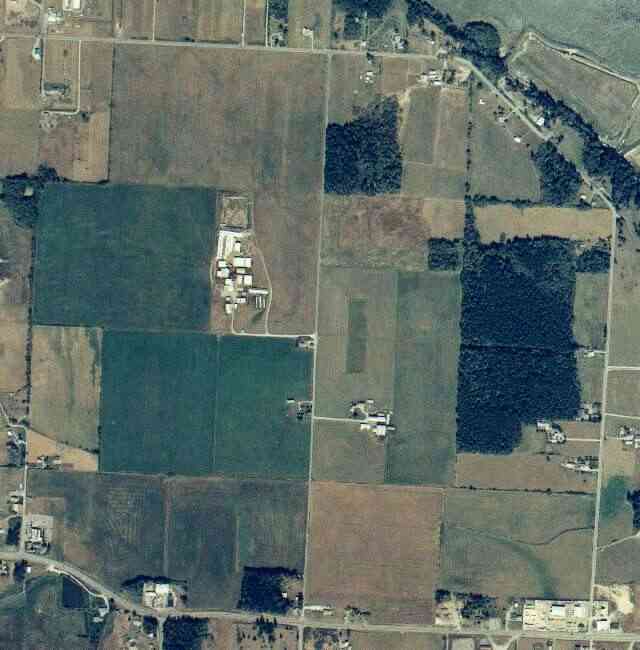
The above September 1997 aerial photo of this section of Camano is from http://www.islandcounty.net/publicworks/digitalphotos/mainmap.htm
The above September 1997 aerial photo of this section of Camano is from
http://www.islandcounty.net/publicworks/digitalphotos/mainmap.htm
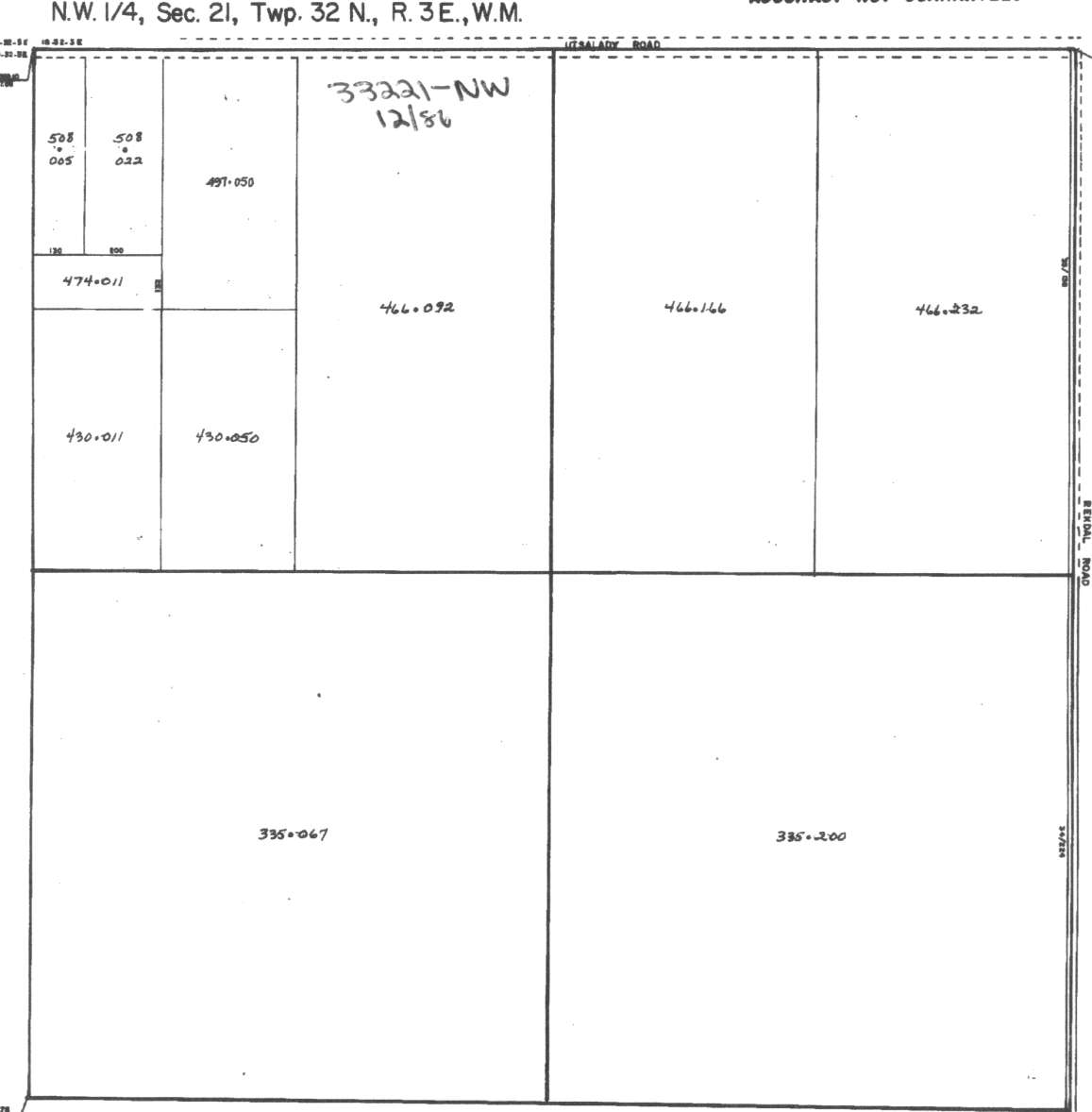
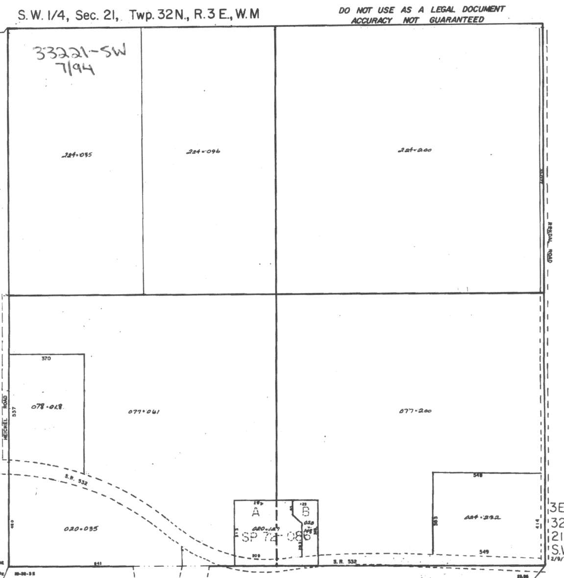
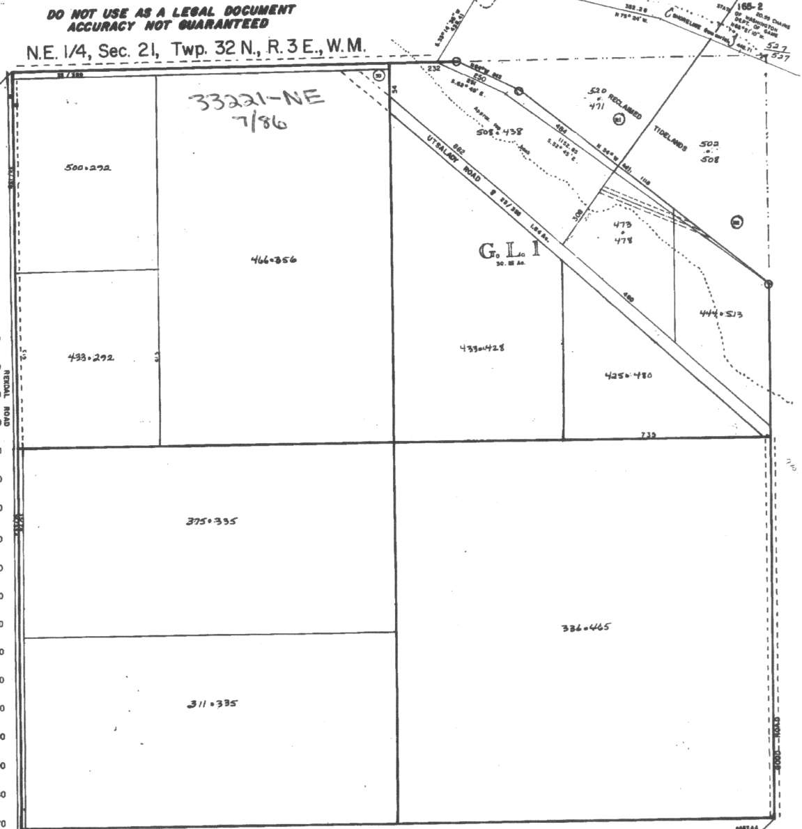
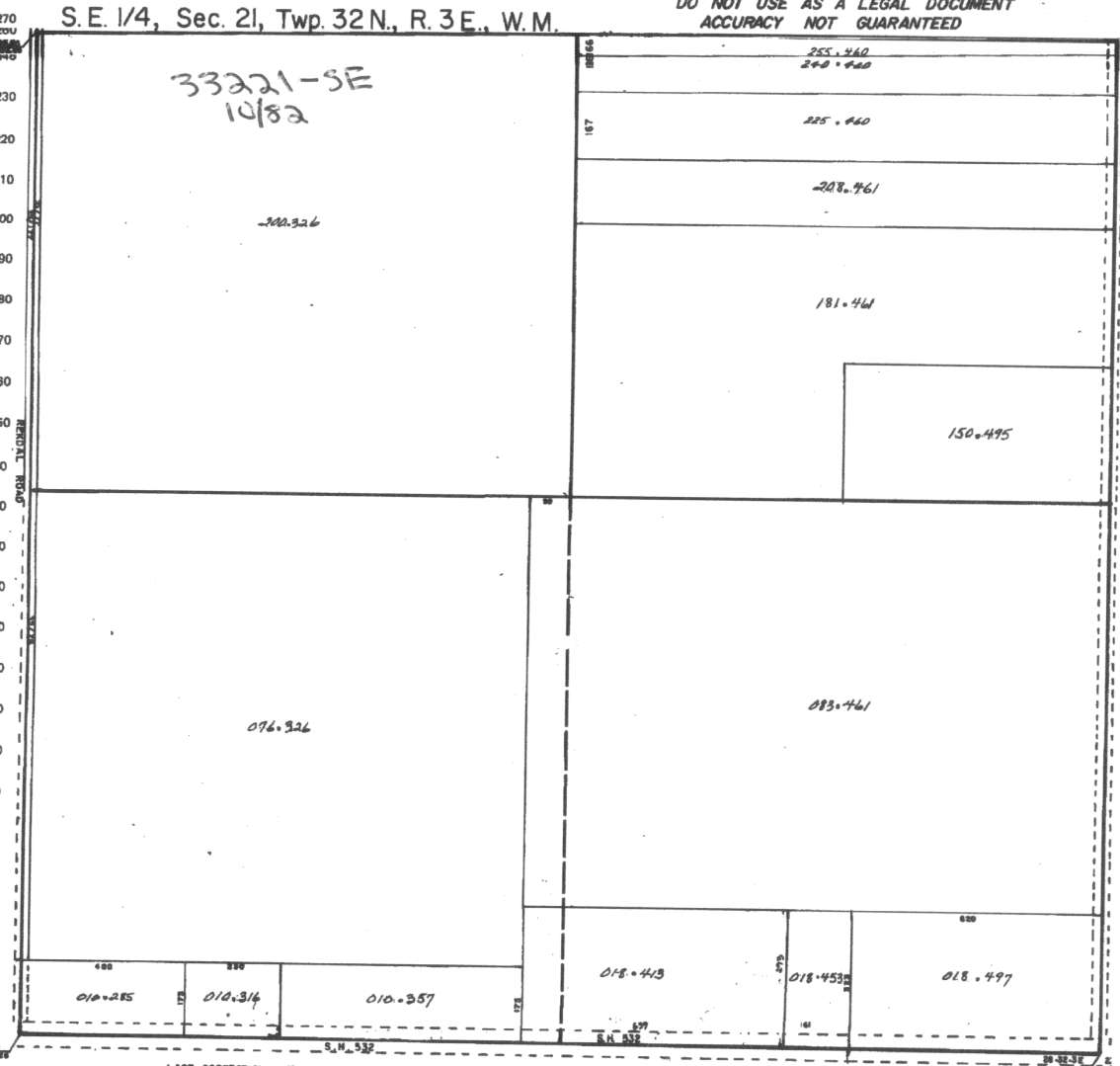
A square system of surveying was ordained by the Continental Congress on May 20, 1785. Within each township (6 miles X 6 miles), are 36 sections. Each section of 640 acres is one mile square (5,280 feet X 5,280 feet). Each quarter section is 160 acres (2,640 feet X 2,640 feet). Most long straight roads and acreage pieces of property have north-south, east-west property lines.
Click on the below Camano section map numbers, to go to a page with Camano Island 2005 assessor data, 1/4 section parcel maps, and aerial photos.
Below are the 14 well reports for this section of Camano, from the December 2004 Washington State Department of Ecology Well log website. Included below is who the well was drilled for, the well depth, and when the well was drilled. At the well log website,
http://apps.ecy.wa.gov/welllog/ more detailed information is available, like the well drillers name, water temperature(sometimes), and soil profile depths.
 <888>
<888>

1. KEVIN SUNDBERGĀ - { view PDF
Ā|Ā view TIFF
}
Public Land Survey: NE, SE, S-21, T-32-N, R-03-E, Tax Parcel Number: (blank)
County: ISLAND, Well Address: GOOD RD, CAMANO ISLAND
Well Log ID: 314577, Well Tag ID: AFK014, Notice of Intent Number: W120073
Well Diameter: 6 (inches), Well Depth: 185 (feet)
Well Type: Water, Well Completion Date: 10/9/2001, Well Log Received Date: 11/1/2001
2. JACK CAMPBELLĀ - { view PDF
Ā|Ā view TIFF
}
Public Land Survey: NW, NE, S-21, T-32-N, R-03-E, Tax Parcel Number: (blank)
County: ISLAND, Well Address: 1110 REKDEL RD, CAMANO ISLAND
Well Log ID: 304126, Well Tag ID: AFJ755, Notice of Intent Number: W098079
Well Diameter: 6 (inches), Well Depth: 150 (feet)
Well Type: Water, Well Completion Date: 8/10/2000, Well Log Received Date: 11/8/2000
3. RON BOLLINGERĀ - { view PDF
Ā|Ā view TIFF
}
Public Land Survey: SW, SE, S-21, T-32-N, R-03-E, Tax Parcel Number: (blank)
County: ISLAND, Well Address: 810 N REKDAL RD, CAMANO ISLAND
Well Log ID: 70197, Well Tag ID: AGA510, Notice of Intent Number: (blank)
Well Diameter: 6 (inches), Well Depth: 149 (feet)
Well Type: Water, Well Completion Date: 1/3/1992, Well Log Received Date: 1/9/1992
4. SIGMUND HANSONĀ - { view PDF
Ā|Ā view TIFF
}
Public Land Survey: NE, SE, S-21, T-32-N, R-03-E, Tax Parcel Number: (blank)
County: ISLAND, Well Address: 1111 N UTSALADY DR, CAMANO ISLAND
Well Log ID: 70630, Well Tag ID: (blank) , Notice of Intent Number: 040868
Well Diameter: 6 (inches), Well Depth: 150 (feet)
Well Type: Water, Well Completion Date: 7/17/1991, Well Log Received Date: 8/2/1991
5. MR. HAYESĀ - { view PDF
Ā|Ā view TIFF
}
Public Land Survey: NW, SW, S-21, T-32-N, R-03-E, Tax Parcel Number: (blank)
County: ISLAND, Well Address: (blank)
Well Log ID: 68368, Well Tag ID: (blank) , Notice of Intent Number: (blank)
Well Diameter: 6 (inches), Well Depth: 80 (feet)
Well Type: Water, Well Completion Date: 9/29/1989, Well Log Received Date: 10/12/1989
6. BURT COSJENSĀ - { view PDF
Ā|Ā view TIFF
}
Public Land Survey: NE, SE, S-21, T-32-N, R-03-E, Tax Parcel Number: (blank)
County: ISLAND, Well Address: (blank)
Well Log ID: 62118, Well Tag ID: (blank) , Notice of Intent Number: (blank)
Well Diameter: 6 (inches), Well Depth: 180 (feet)
Well Type: Water, Well Completion Date: 6/30/1989, Well Log Received Date: 7/19/1989
7. MR. & MRS. ISAARĀ - { view PDF
Ā|Ā view TIFF
}
Public Land Survey: NW, NW, S-21, T-32-N, R-03-E, Tax Parcel Number: (blank)
County: ISLAND, Well Address: (blank)
Well Log ID: 68185, Well Tag ID: (blank) , Notice of Intent Number: (blank)
Well Diameter: 6 (inches), Well Depth: 180 (feet)
Well Type: Water, Well Completion Date: 12/23/1988, Well Log Received Date: 1/23/1989
8. LOUIS STANYALANDĀ - { view PDF
Ā|Ā view TIFF
}
Public Land Survey: NE, SW, S-21, T-32-N, R-03-E, Tax Parcel Number: (blank)
County: ISLAND, Well Address: GOOD RD, CAMANO ISLAND, 98292
Well Log ID: 67415, Well Tag ID: (blank) , Notice of Intent Number: (blank)
Well Diameter: 8 (inches), Well Depth: 180 (feet)
Well Type: Water, Well Completion Date: 6/1/1977, Well Log Received Date: (blank)
9. ALF DANIELSONĀ - { view PDF
Ā|Ā view TIFF
}
Public Land Survey: NE, NW, S-21, T-32-N, R-03-E, Tax Parcel Number: (blank)
County: ISLAND, Well Address: (blank)
Well Log ID: 61118, Well Tag ID: (blank) , Notice of Intent Number: (blank)
Well Diameter: 6 (inches), Well Depth: 158 (feet)
Well Type: Water, Well Completion Date: 5/28/1964, Well Log Received Date: 9/1/1989
10. AL DAMLELSONĀ - { view PDF
Ā|Ā view TIFF
}
Public Land Survey: NE, NW, S-21, T-32-N, R-03-E, Tax Parcel Number: (blank)
County: ISLAND, Well Address: (blank)
Well Log ID: 61016, Well Tag ID: (blank) , Notice of Intent Number: (blank)
Well Diameter: 8 (inches), Well Depth: 171 (feet)
Well Type: Water, Well Completion Date: 6/9/1956, Well Log Received Date: (blank)
11. AL DANIELSONĀ - { view PDF
Ā|Ā view TIFF
}
Public Land Survey: NE, NW, S-21, T-32-N, R-03-E, Tax Parcel Number: (blank)
County: ISLAND, Well Address: (blank)
Well Log ID: 61017, Well Tag ID: (blank) , Notice of Intent Number: (blank)
Well Diameter: 8 (inches), Well Depth: 171 (feet)
Well Type: Water, Well Completion Date: 6/9/1956, Well Log Received Date: (blank)
12. ALF L DANIELSONĀ - { view PDF
Ā|Ā view TIFF
}
Public Land Survey: (blank), NW, S-21, T-32-N, R-03-E, Tax Parcel Number: (blank)
County: ISLAND, Well Address: (blank)
Well Log ID: 351189, Well Tag ID: (blank) , Notice of Intent Number: (blank)
Well Diameter: 8 (inches), Well Depth: 170 (feet)
Well Type: Water, Well Completion Date: 6/9/1956, Well Log Received Date: (blank)
13. MARTIN JOHNSONĀ - { view PDF
Ā|Ā view TIFF
}
Public Land Survey: (blank), (blank), S-21, T-32-N, R-03-E, Tax Parcel Number: (blank)
County: ISLAND, Well Address: (blank)
Well Log ID: 67692, Well Tag ID: (blank) , Notice of Intent Number: (blank)
Well Diameter: 6 (inches), Well Depth: 89 (feet)
Well Type: Water, Well Completion Date: 7/15/1952, Well Log Received Date: (blank)
14. SVEND LARSENĀ - { view PDF
Ā|Ā view TIFF
}
Public Land Survey: NW, SE, S-21, T-32-N, R-03-E, Tax Parcel Number: (blank)
County: ISLAND, Well Address: (blank)
Well Log ID: 351190, Well Tag ID: (blank) , Notice of Intent Number: (blank)
Well Diameter: 12 (inches), Well Depth: 135 (feet)
Well Type: Water, Well Completion Date: 6/11/1949, Well Log Received Date: (blank)