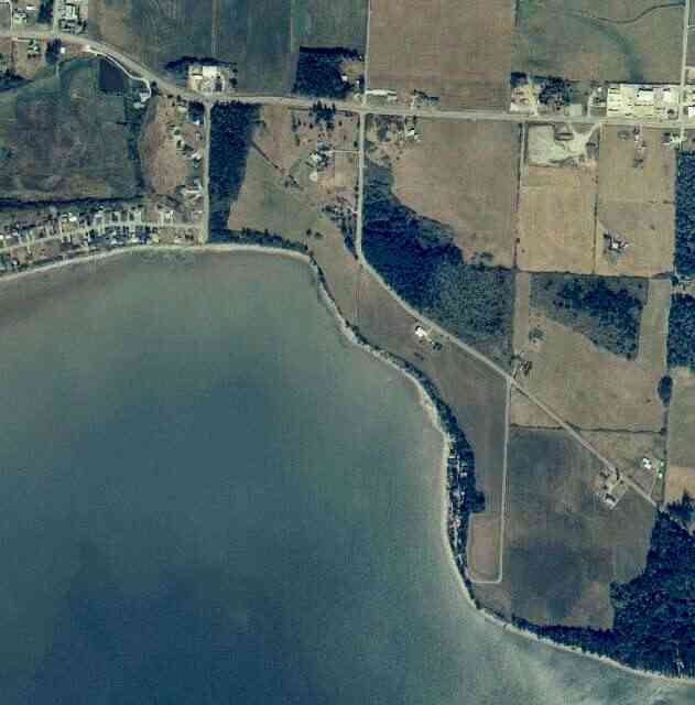
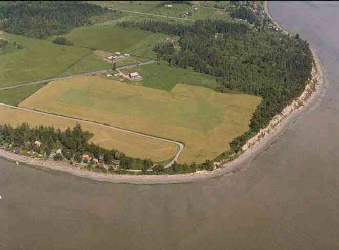
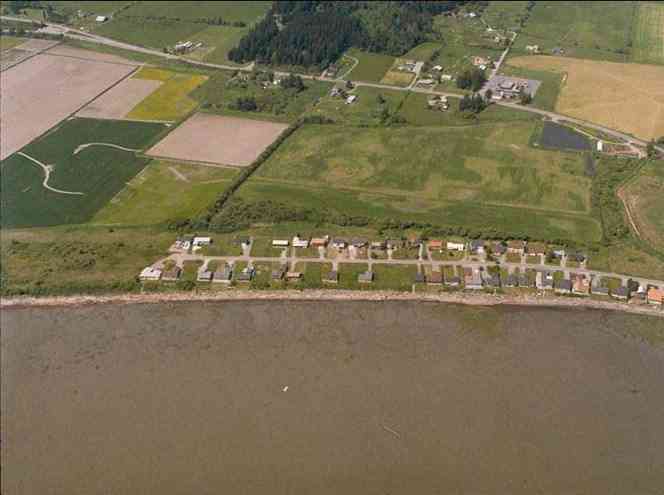
The above September 1997 aerial photo of this section of Camano is from http://www.islandcounty.net/publicworks/digitalphotos/mainmap.htm
The above September 1997 aerial photo of this section of Camano is from
http://www.islandcounty.net/publicworks/digitalphotos/mainmap.htm
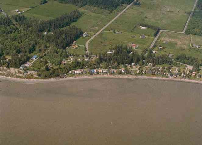
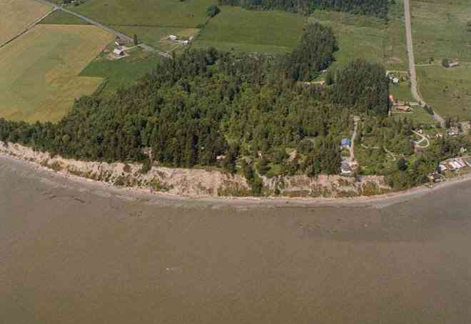
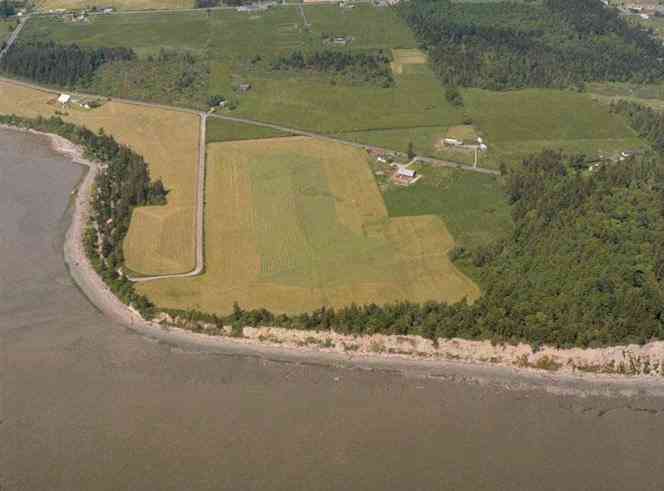
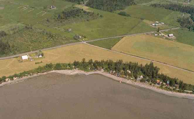
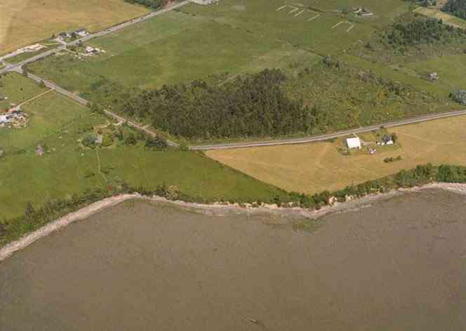
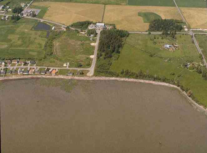
The below 5/11/1993 2:42:00 PM aerial photos are from:
http://apps.ecy.wa.gov/shorephotos
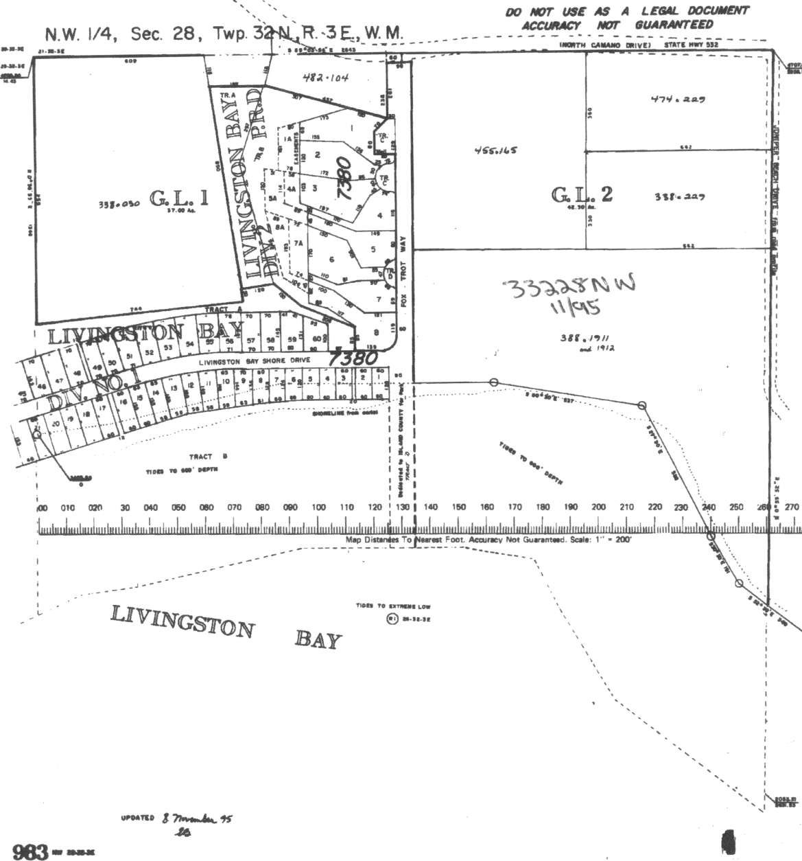
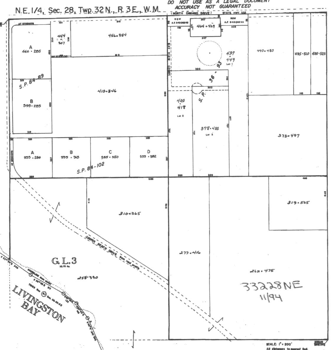
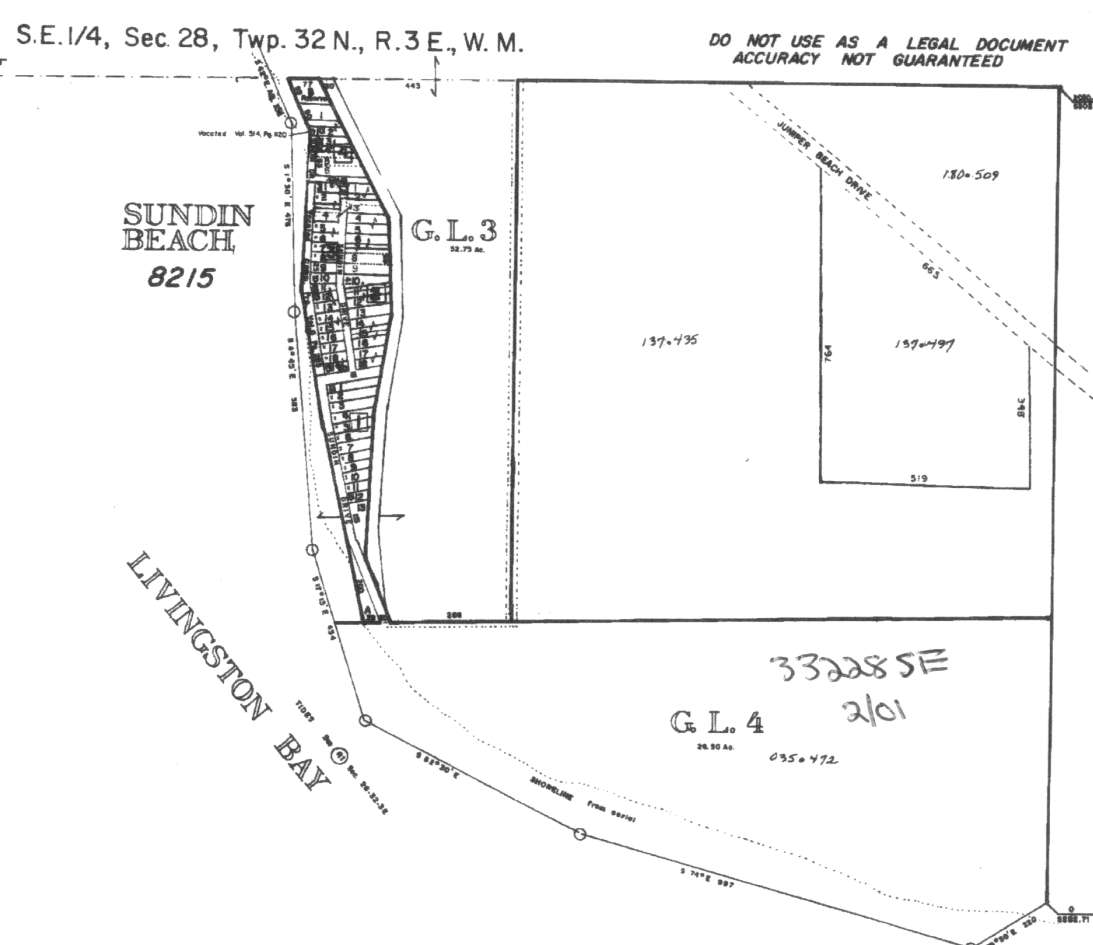
A square system of surveying was ordained by the Continental Congress on May 20, 1785. Within each township (6 miles X 6 miles), are 36 sections. Each section of 640 acres is one mile square (5,280 feet X 5,280 feet). Each quarter section is 160 acres (2,640 feet X 2,640 feet). Most long straight roads and acreage pieces of property have north-south, east-west property lines.
Click on the below Camano section map numbers, to go to a page with Camano Island 2005 assessor data, 1/4 section parcel maps, and aerial photos.
Below are the 15 well reports for this section of Camano, from the December 2004 Washington State Department of Ecology Well log website. Included below is who the well was drilled for, the well depth, and when the well was drilled. At the well log website,
http://apps.ecy.wa.gov/welllog/ more detailed information is available, like the well drillers name, water temperature(sometimes), and soil profile depths.
 <888>
<888>

1. KARIM KHOURYĀ - { view PDF
Ā|Ā view TIFF
}
Public Land Survey: NE, SE, S-28, T-32-N, R-03-E, Tax Parcel Number: (blank)
County: ISLAND, Well Address: LOT B JUNIPER BEACH RD, CAMANO ISLAND 98282
Well Log ID: 386151, Well Tag ID: ALA103, Notice of Intent Number: WE02590
Well Diameter: 6 (inches), Well Depth: 119 (feet)
Well Type: Water, Well Completion Date: 8/27/2004, Well Log Received Date: 9/10/2004
2. DAVE PLATTER / TR CAMANOĀ - { view PDF
Ā|Ā view TIFF
}
Public Land Survey: NW, NE, S-28, T-32-N, R-03-E, Tax Parcel Number: (blank)
County: ISLAND, Well Address: 1172 SR 532, CAMANO ISLAND
Well Log ID: 380801, Well Tag ID: AKY861, Notice of Intent Number: W177613
Well Diameter: 6 (inches), Well Depth: 170 (feet)
Well Type: Water, Well Completion Date: 4/30/2004, Well Log Received Date: 6/1/2004
3. COWIN CONSTĀ - { view PDF
Ā|Ā view TIFF
}
Public Land Survey: NW, NE, S-28, T-32-N, R-03-E, Tax Parcel Number: (blank)
County: SNOHOMISH, Well Address: 1001 JUNIPER BEACH RD, CAMANO ISLAND 98282
Well Log ID: 379467, Well Tag ID: AGF467, Notice of Intent Number: W156129
Well Diameter: 6 (inches), Well Depth: 135 (feet)
Well Type: Water, Well Completion Date: 4/15/2004, Well Log Received Date: 5/12/2004
4. JP DEBOERĀ - { view PDF
Ā|Ā view TIFF
}
Public Land Survey: SW, NE, S-28, T-32-N, R-03-E, Tax Parcel Number: (blank)
County: ISLAND, Well Address: JUNIPER BEACH, CAMANO ISLAND
Well Log ID: 376910, Well Tag ID: AKY866, Notice of Intent Number: W175542
Well Diameter: 6 (inches), Well Depth: 78.5 (feet)
Well Type: Water, Well Completion Date: 3/3/2004, Well Log Received Date: 3/17/2004
5. COWIN CONSTRUCTIONĀ - { view PDF
Ā|Ā view TIFF
}
Public Land Survey: NW, NE, S-28, T-32-N, R-03-E, Tax Parcel Number: (blank)
County: ISLAND, Well Address: XXX JUNIPER BEACH RD, CAMANO ISLAND 98282
Well Log ID: 379180, Well Tag ID: AGF462, Notice of Intent Number: W156124
Well Diameter: 6 (inches), Well Depth: 130 (feet)
Well Type: Water, Well Completion Date: 12/20/2003, Well Log Received Date: 1/29/2004
6. CHARLES PRATTĀ - { view PDF
Ā|Ā view TIFF
}
Public Land Survey: NW, NE, S-28, T-32-N, R-03-E, Tax Parcel Number: R33228-399-2850
County: ISLAND, Well Address: XXX JUNIPER BEACH RD, CAMANO ISLAND, 98282
Well Log ID: 359610, Well Tag ID: ABO940, Notice of Intent Number: W153726
Well Diameter: 6 (inches), Well Depth: 95 (feet)
Well Type: Water, Well Completion Date: 4/24/2003, Well Log Received Date: 5/9/2003
7. MICHAEL FISHERĀ - { view PDF
Ā|Ā view TIFF
}
Public Land Survey: NE, NE, S-28, T-32-N, R-03-E, Tax Parcel Number: R33228-435-5250
County: ISLAND, Well Address: 1196 E SR 532, CAMANO ISLAND, 98282
Well Log ID: 359607, Well Tag ID: ABO938, Notice of Intent Number: W153721
Well Diameter: 6 (inches), Well Depth: 166 (feet)
Well Type: Water, Well Completion Date: 3/28/2003, Well Log Received Date: 5/9/2003
8. GLENN RENGENĀ - { view PDF
Ā|Ā view TIFF
}
Public Land Survey: NE, NE, S-28, T-32-N, R-03-E, Tax Parcel Number: (blank)
County: ISLAND, Well Address: 718 BAYVIEW CT, CAMANO ISLAND, 98282
Well Log ID: 348015, Well Tag ID: ABO927, Notice of Intent Number: W118530
Well Diameter: 6 (inches), Well Depth: 153 (feet)
Well Type: Water, Well Completion Date: 11/14/2002, Well Log Received Date: 12/9/2002
9. BERNIY CROPPIĀ - { view PDF
Ā|Ā view TIFF
}
Public Land Survey: SE, NW, S-28, T-32-N, R-03-E, Tax Parcel Number: R33228-410-3460
County: SNOHOMISH, Well Address: XXX JUNIPER BEACH RD, CAMANO ISLAND 98282
Well Log ID: 348016, Well Tag ID: ABO924, Notice of Intent Number: W153712
Well Diameter: 6 (inches), Well Depth: 138 (feet)
Well Type: Water, Well Completion Date: 10/28/2002, Well Log Received Date: 12/9/2002
10. TERRY GREERĀ - { view PDF
Ā|Ā view TIFF
}
Public Land Survey: NW, NE, S-28, T-32-N, R-03-E, Tax Parcel Number: R33228-355-3500
County: ISLAND, Well Address: XXX JUNIPER BEACH RD, CAMANO ISLAND
Well Log ID: 336707, Well Tag ID: ABO913, Notice of Intent Number: W118546
Well Diameter: 6 (inches), Well Depth: 128 (feet)
Well Type: Water, Well Completion Date: 7/22/2002, Well Log Received Date: 7/30/2002
11. COWIN CONSTRUCTIONĀ - { view PDF
Ā|Ā view TIFF
}
Public Land Survey: NW, NE, S-28, T-32-N, R-03-E, Tax Parcel Number: (blank)
County: ISLAND, Well Address: XXX JUNIPER BEACH RD, CAMANO ISLAND 98282
Well Log ID: 374150, Well Tag ID: AGF461, Notice of Intent Number: W156123
Well Diameter: 6 (inches), Well Depth: 135 (feet)
Well Type: Water, Well Completion Date: 1/11/2001, Well Log Received Date: 1/29/2004
12. KEVIN REIMERĀ - { view PDF
Ā|Ā view TIFF
}
Public Land Survey: NW, NW, S-28, T-32-N, R-03-E, Tax Parcel Number: (blank)
County: ISLAND, Well Address: (blank)
Well Log ID: 304127, Well Tag ID: AFK003, Notice of Intent Number: W120066
Well Diameter: 8 (inches), Well Depth: 160 (feet)
Well Type: Water, Well Completion Date: 11/7/2000, Well Log Received Date: 11/27/2000
13. KEVIN - HOPE REIMERĀ - { view PDF
Ā|Ā view TIFF
}
Public Land Survey: NW, NW, S-28, T-32-N, R-03-E, Tax Parcel Number: (blank)
County: ISLAND, Well Address: XXX LIVIRGSTON BAY ROAD, CAMANO ISLAND, WA
Well Log ID: 248159, Well Tag ID: ABD745, Notice of Intent Number: W098081
Well Diameter: 6 (inches), Well Depth: 46 (feet)
Well Type: Water, Well Completion Date: 5/24/2000, Well Log Received Date: 6/27/2000
14. STANLEY STAMNĀ - { view PDF
Ā|Ā view TIFF
}
Public Land Survey: SE, SE, S-28, T-32-N, R-03-E, Tax Parcel Number: (blank)
County: ISLAND, Well Address: 1272 JUNIPER BEACH RD
Well Log ID: 70711, Well Tag ID: (blank) , Notice of Intent Number: 074539
Well Diameter: 6 (inches), Well Depth: 118 (feet)
Well Type: Water, Well Completion Date: 3/20/1990, Well Log Received Date: (blank)
15. FOX HILL DEVELOPMENTĀ - { view PDF
Ā|Ā view TIFF
}
Public Land Survey: NW, NW, S-28, T-32-N, R-03-E, Tax Parcel Number: (blank)
County: ISLAND, Well Address: (blank)
Well Log ID: 351194, Well Tag ID: (blank) , Notice of Intent Number: (blank)
Well Diameter: 6 (inches), Well Depth: 80 (feet)
Well Type: Water, Well Completion Date: (blank) , Well Log Received Date: (blank)